Fall Into the Porkies: Camping in Michigan’s Wilderness

Fall Into the Porkies: Camping in Michigan’s Wilderness
The sun sets over Porcupine Mountains Wilderness State Park. (John McCormick/Shutterstock)
9/27/2021
Updated:
9/27/2021
The sunset smolders to embers on the horizon and a mild wind pushes waves off Lake Superior into shore where we sit watching the light show finish up and the stars take over. The temperature will dip toward 50 or lower tonight, but the fall air is more invigorating than biting, and a good meal around the campfire—some reheated local pasties in a cast-iron pan—warms our insides before we head to our sleeping bags in the tent.
The soughing wind through the treetops is white noise and the day rests here at the Porcupine Mountains Wilderness State Park.
A river snakes through the wilderness. (Dan Thornberg/Shutterstock)

Wilderness Preserved

The Porcupine Mountains or “the Porkies” are a range of small mountains along the Lake Superior coastline of Michigan’s Upper Peninsula, just a few miles north of the Wisconsin border. The protected 60,000 acres make it Michigan’s largest state park. Just over half of those acres are covered in old-growth forest, having escaped the lumberjacks who clear-cut so much of the region.
Hikers take in views of Lake of the Clouds. (Kevin Revolinski)

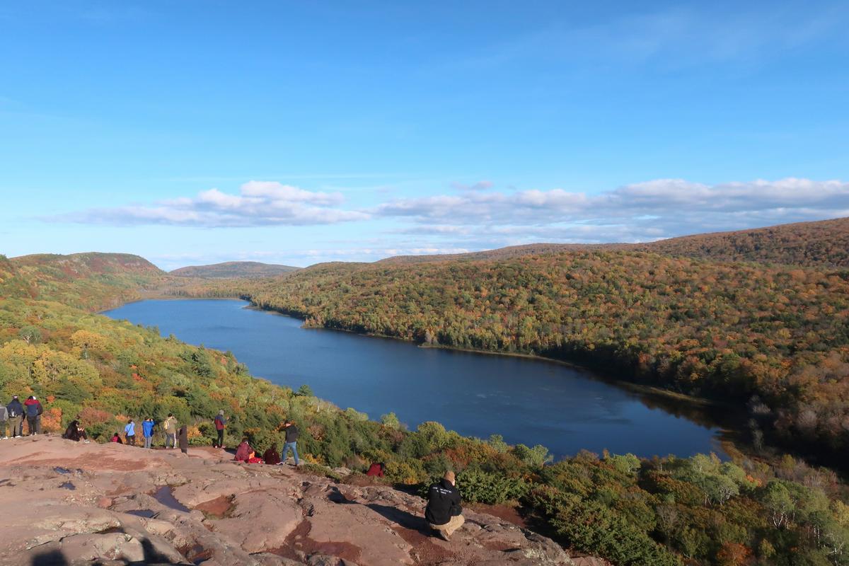
The pristine forest and the rich understory it sustains aren’t the whole of the “wild” in the wilderness. The preserve is also home to an assortment of woodland creatures, including abundant deer, black bears, timber wolves, beavers, river otters, and the occasional moose. Birders have counted nearly 400 feathered species in the region, from the rare Kirtland’s warbler to the bald eagle and peregrine falcon. While you may also see actual porcupines, the name of mountains comes from the way the trees looked along the ridge.

A wooden bridge stands over a rushing river. (Marissa English/Shutterstock)

Colors Galore

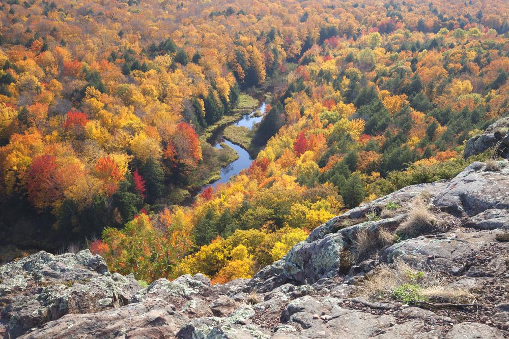
Because of the forest’s abundant hardwoods, the autumnal color show is impressive. The overlooks make for amazing panoramic views, and the rugged hiking trails set you right down within it and the road between the two campgrounds runs the length of the park for a color drive.

The most popular destination within the park and a good view of fall is the scenic overlook of Lake of the Clouds. A drive or hike up the ridge arrives at a parking area a short walk from the bare rock of a basalt escarpment. You can look out over the long narrow and photogenic Lake of the Clouds stretching out below.

Conglomerate Falls along the Black River in the bordering Ottawa National Forest. (Kevin Revolinski)

A hike to Summit Peak, the park’s highest point, leads to a 50-foot observation tower, offering views of the big lake out over the color palette. On the clearest days, the view extends all the way to Wisconsin’s Apostle Islands or even to Isle Royale near the Canadian side of the lake.

Copper Peak is a 360-foot volcano-formed rock outcrop along the Black River National Forest Scenic Byway, just east of the state park. You can drive up the hill or ride a ski-lift to reach the summit where stands a towering professional ski jump. An elevator takes visitors up 18 stories for the view, and stairs climb another eight stories to more dizzying perches not meant for acrophobes. Clear-day views go all the way to Minnesota and Canada across Lake Superior. Needless to say, you see the entire sea of fall color from up here.
The Manabezho Falls, located in the Porcupine Mountains, are part of the Presque Isle River's spectacular final dash to Lake Superior. (Footsore Fotography/Shutterstock)

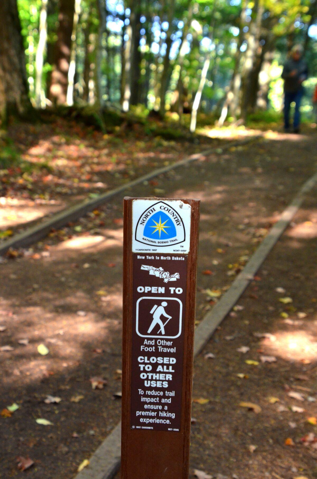
Bring Your Hiking Boots

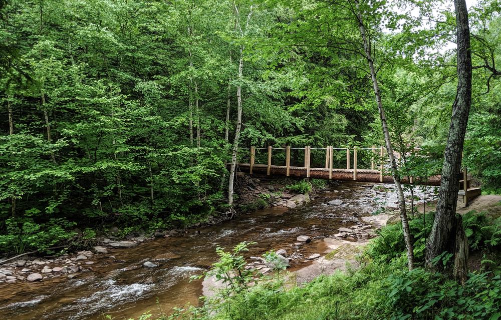
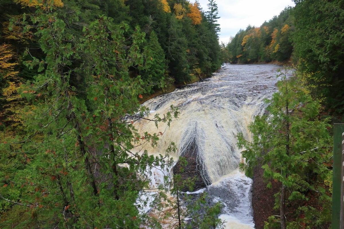
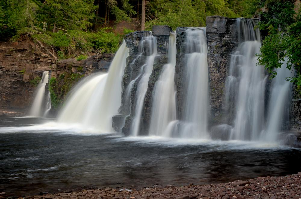
Trekkers can enjoy more than 90 miles of trails, ranging from gentle walks along the river to steeper or more remote paths. The Presque Isle River, which kicks up whitewater over dramatic rock formations and offers views of several named waterfalls, empties into Lake Superior right next to its namesake campground. The trails from that point lead upstream along either bank and are easily accessed for daytrippers.
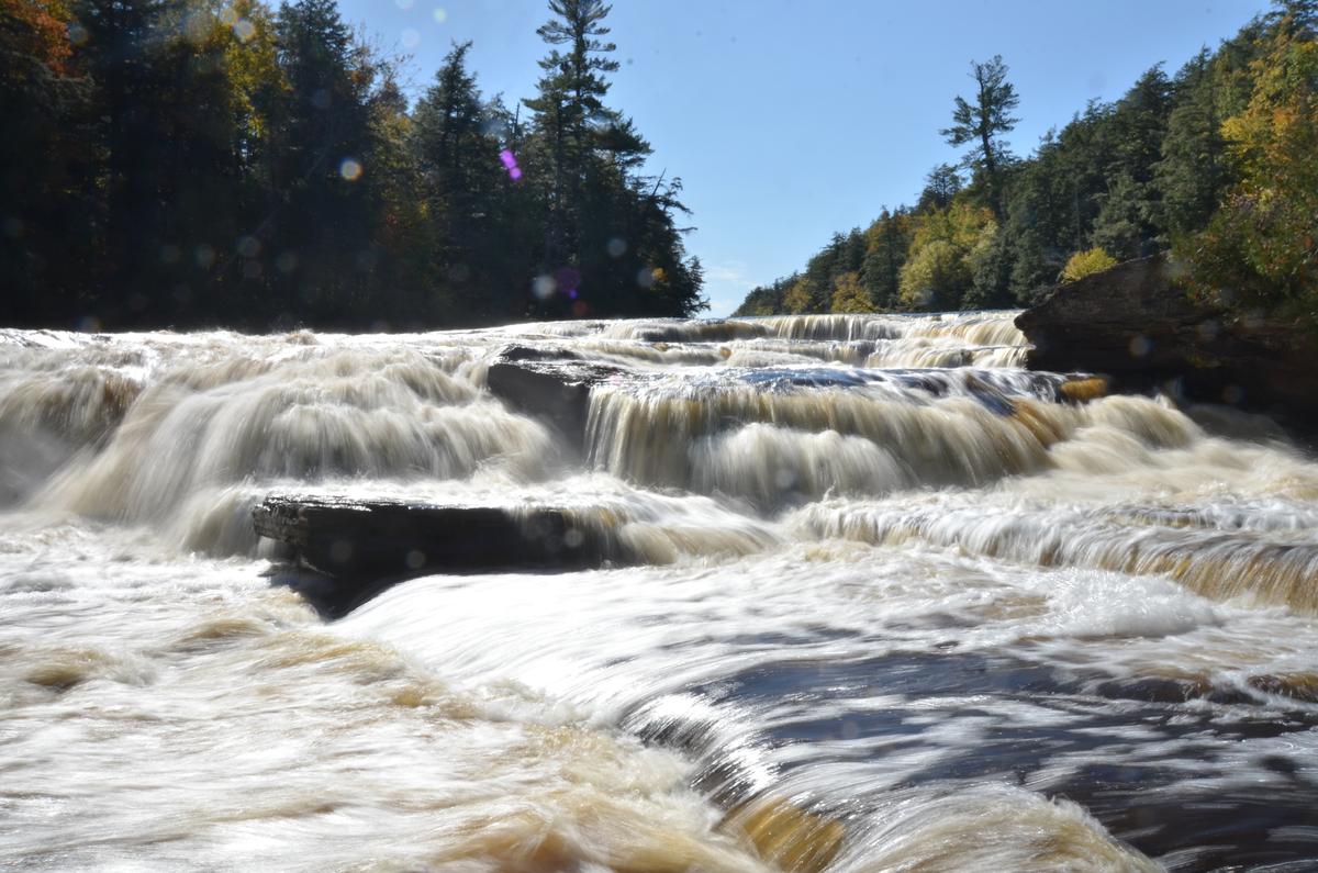
The North Country National Scenic Trail (NCT)—at 4,600 miles, the longest of the 11 such designated paths—runs about 18 miles through the park and continues in wilderness as it heads east and into Ottawa National Forest on its way to Wisconsin to the southwest.
Nawadaha Falls on the Presque Isle River. (Kevin Revolinski)

Roughing It

The Porkies are a perfect place to experience the joy of camping: forest-bathing the mind, stretching the muscles on a walk in the woods, taking a quiet moment to appreciate the beauty of the natural world, and quality time around a campfire at night.

Rustic campsites, sites with electrical hookups, and walk-in sites serve Presque Isle Campground at the southern end of the park, while Union Bay Campgrounds has modern sites and facilities at the northern end. Deeper into the woods are backpacker sites, yurts, rustic cabins, and small, basic outpost sites that serve tents and small campers.

Lake Superior, the backdrop of a campsite in the Presque Isle campground within Porcupine Mountains Wilderness State Park. (Kevin Revolinski)

If camping isn’t your thing, you can still try Kaug Wudjoo Lodge—an Objibwa name that means “place of the crouching porcupine”—a modern, fully furnished four-bedroom lodge that sleeps up to 12. From May through November, there is a seven-day minimum stay and a four-day minimum otherwise.

A sign marks the trail. (Kevin Revolinski)

Planning Your Trip

We booked our campsite online using the Michigan Department of Natural Resources’ excellent reservation system. A map of the selected park pops up with color-coded availability at both campgrounds plus backcountry sites and cabins. Sites offer photos so you can choose better for shade, privacy, etc.
As for timing, Pure Michigan has a fall color map with projected peak times, but we found the Wisconsin fall color map is much more precise, colored by county, displaying percentages of color and specific hover-over destinations highlighted and updated regularly. Look for Hurley in Iron County bordering Michigan and Lake Superior just south of the Porkies.
The beauty of the season adorns the forest in autumnal glory. (Kevin Revolinski)

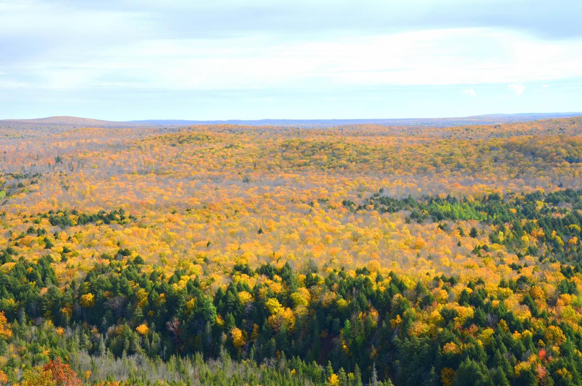
Too late for a fall visit? The Porkies are great any time of year, actually—spring and summer, of course, but also the winter months: alpine and cross-country skiing are popular, and overnight visitors can rent cabins in the snowy woods. Some roads close Dec. 1 and open up for snowmobiles when the snow arrives, but the road to Presque Isle Scenic Area remains open.

Kevin Revolinski is an avid traveler, craft beer enthusiast, and home-cooking fan. He is the author of 15 books, including “The Yogurt Man Cometh: Tales of an American Teacher in Turkey” and his new collection of short stories, “Stealing Away.” He’s based in Madison, Wis., and his website is TheMadTraveler.com
Related Topics