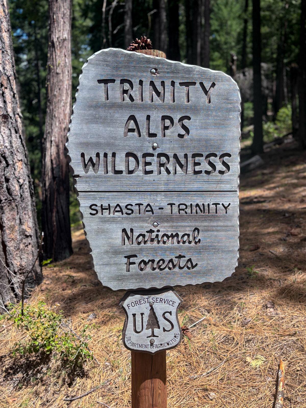
Remote and far less traveled than national parks of similar beauty, the Trinity Alps Wilderness in Northern California is the adventure that’s been calling to your wild heart. But you’ve likely never heard of it.
Three hours north of Sacramento, the Trinity Alps encompasses about 540,000 acres and features massive waterfalls, crystal-clear rivers and creeks, and dozens of turquoise alpine lakes. It has more than 550 miles of hiking trails, including several treks where you can find yourself in solitude in dense conifer forests with sweeping mountain views.
The Trinity Alps is the second-largest wilderness area in California and is managed by three agencies: Klamath National Forest (75,809 acres of the Trinity Alps), Shasta-Trinity National Forest (410,965 acres of the Trinity Alps) and Six Rivers National Forest (50,583 acres of the Trinity Alps).
For those wishing for a Yosemite-like adventure without the crowds, the Trinity Alps offers a tremendously diverse landscape that’s often broken into three regions.
“The western half—known as the Green Alps—sees up to twice as much precipitation as the eastern half and are composed of much gentler mountains,” wrote ecologist Michael Kauffmann. “The central granitic batholith defines the White Alps, a land of spires and glacially carved valleys with hanging lakes as a result. The eastern-most section is called the Red Alps because serpentine soils are common.”


This guide is written for outdoors lovers who’d like to car-camp and day-hike, although it will provide helpful information for those who’d rather stay in cabins or, on the opposite end of adventure, go backpacking.
What to Bring
The weather and temperature will vary widely in the Trinity Alps, given elevation ranges from about 2,000 to 9,000 feet. Check weather forecasts and pack accordingly based on the season you’re arriving. If unsure, call the ranger station in the region where you’re staying. Regardless, pack the correct provisions, so that you’ll have enough for a day hike if you had to spend the night in the elements.If camping, you’ll want to pack the usual gear, including a tent, sleeping bags, an air mattress or other cushioning, extra blankets and pillows. There is minimal to no light pollution in Trinity Alps, meaning it can be near pitch-black at your campground. Make sure you pack multiple light sources, including headlamps and lanterns, and if they are not solar-powered, don’t forget the batteries.
You can buy food and other supplies in Weaverville, Redding or other nearby towns. Local stores will sell either Styrofoam or compostable coolers. If camping or backpacking, you’ll need to grab a free wilderness permit, available at the Weaverville Ranger and the Shasta Lake Ranger stations. Some campgrounds have bear boxes while others recommend leaving food out of sight in your vehicle. Bring a few thick trash bags to wrap around your cooler to help cut the food scent regardless of where you store it.
Given the spotty, sometimes nonexistent cellphone reception, you must download a map of the area. It is also prudent to bring a paper map of the area, available at REI and other outdoors supply stores. I’d also recommend purchasing a Trinity Alps-focused hiking book, which will provide you with far more context and information than most outdoor adventure apps.
Trinity Alps is home to black bears. You should pack bear spray (if you drive there) or purchase it at an outdoors supply store (if you fly there). It’s also home to elk, which you should give a wide berth if you’re lucky enough to see one.
Although you’ll likely see other hikers and backpackers on popular trails, it’s easy to find yourself entirely alone in the Trinity Alps. For that reason, it’s best to either travel with friends, or have a loved one you’re regularly checking in with.
Getting There
The Weaverville Ranger Station, a great starting point for anyone visiting the Trinity Alps, is just over a three-hour drive north from the Sacramento airport.Flying to Sacramento and renting a car (preferably all-wheel or four-wheel drive for this trip) at the Sacramento airport is as simple as taking a shuttle to the rental car offices near the airport. You could also fly into San Francisco, although this will extend your journey about two hours. Those who love a road trip could drive the 9 1/2 hours from L.A., staying at fun motels along the way.
Staying Safe
Hikers often consider what they’ll do if they run into bears, snakes and other wildlife but ignore one of the most significant dangers they’ll encounter: water.The Trinity Alps is threaded with several gorgeous rivers and creeks that seem to call to the hiker to come take a swim. You should use extreme caution when crossing these waterways, especially earlier in the summer when they’re still deep, the water cold and the current swift.
Where to Stay
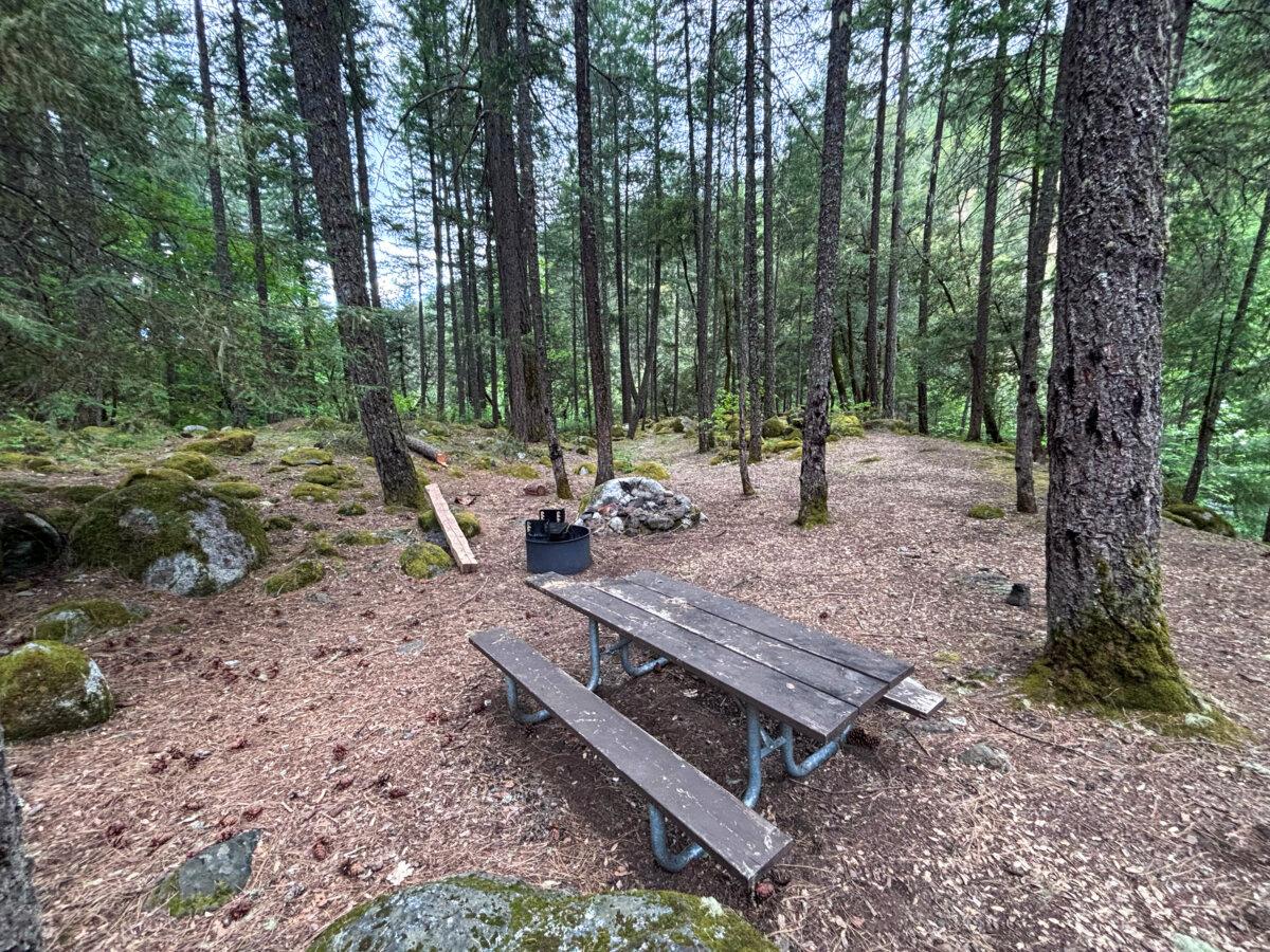
The Trinity Alps is home to several campgrounds, resorts and limitless backcountry camping spots. There are several campgrounds around Trinity Lake, including Hayward Flat, Jackass Springs and Bushytail, which has showers. Rental cabins and resorts (and also a Buddhist retreat center where you can rent various accommodations) are scattered throughout the Trinity Alps for those wanting to sleep in something beyond a nylon-walled tent.Here are some of the campgrounds that hikers should consider when planning a trip to the Trinities.
Big Flat Campground
Coordinates: 41.06774331659005, -122.93508337539711Cost: No fee.
Bathrooms: Vault toilets.
Water: Creek only; will need to boil what you collect or bring a filter.
Open: Seasonally, depending on snow levels.
Dogs allowed? Yes.
Remote and deeper in the Trinities than others on this list, the Big Flat campground in Klamath National Forest has nine first-come, first-served campsites just off the South Fork of the Salmon River. It is farther north than other sites on this list, nearest to the Coffee Creek community where there’s a general store that sells cold beer and sandwiches.
Bridge Camp Campground
Coordinates: 40.87315136119416, -122.91633473487053Cost: $20/night.
Bathrooms: Vault toilets.
Water: Potable water available from Memorial Day to Oct. 31.
Open: Year-round.
Dogs allowed? Yes.
Bridge Camp is a 10-site first-come, first-served campground situated along the Stuart Fork, a tributary of the Trinity River, in Shasta-Trinity National Forest. Situated about 17 miles north of Weaverville, the campground has potable water available from Memorial Day to Oct. 31.
To reach the campground, you’ll drive through the charming Trinity Alps Resort, which rents out rustic red cabins named after California counties, and onto a narrow gravel road. Use extreme caution on this final stretch of your journey as the southern edge of the roadway has a steep drop-off that plunges down to the Stuart Fork.
The campground is an arboreous escape shaded by massive old trees and, under safe conditions, guests can enjoy a cool dip in Stuart Fork’s clear waters.
Backpackers will often stay a night here because it shares its location with the Stuart Fork Trailhead, where they can start a multi-day trip to Emerald and Sapphire Lakes, which are 14 and 15 miles away, respectively. This trip to reach the 21-acre Emerald Lake (at a depth of 68 feet) and 43-acre Sapphire Lake (at 200 feet deep) is one of the most popular among backpackers in the Trinities. The Stuart Fork trail also makes for great day hiking regardless of how far you go.
Mary Smith Campground
Coordinates: 40.731118668910945, -122.8077442443847Cost: $30-135 plus fees.
Bathrooms: Flush and vault toilets.
Water: Potable water available.
Open: Generally open from early April through Oct. 31. Reservations required from June 8 to Sept. 30.
Dogs allowed? Dogs are not allowed inside the yurts but are allowed in kennels outside the units, and at tent sites.
Mary Smith, a 17-site campground on Lewiston Lake shoreline, treats guests with one thing none of the other sites on this list provide: glamping. Six of its campsites, each available to reserve through recreation.gov, offer yurts including queen beds with linens, down comforters and pillows, along with two nightstands and an oversized rug. Outside the yurts, guests will find armchairs, a coffee table, fire pit and picnic table. Not a bad place to rest after hiking and swimming all day!
Ripstein Campground
Coordinates: 40.87632941356905, -123.02811654908179Cost: No fee.
Bathrooms: Vault toilets.
Water: Creek only; will need to boil what you collect or bring a filter.
Open: Open year-round.
Dogs allowed? Yes.
Ripstein is a 10-site first-come, first-served campground in Shasta-Trinity National Forest that’s shaded by tall trees with a natural soundscape of nearby Canyon Creek. It has multiple roomy campsites, including a few next to the river that deliver pristine views and privacy.
The popular Canyon Creek Trailhead is just under a mile away, and a popular swim area is close too. Nearby parking areas can fill up on weekends so it’s best to arrive early to the trailhead or walk from your campground. Backpackers use this campground as a quick stopover before heading out.
Although Ripstein doesn’t have potable water or flush toilets, it boasts a landscape so vibrant and green, it feels like walking into a fairy tale. For those campers willing to rough it a bit, it’s an A-plus choice.
Where to Day-hike
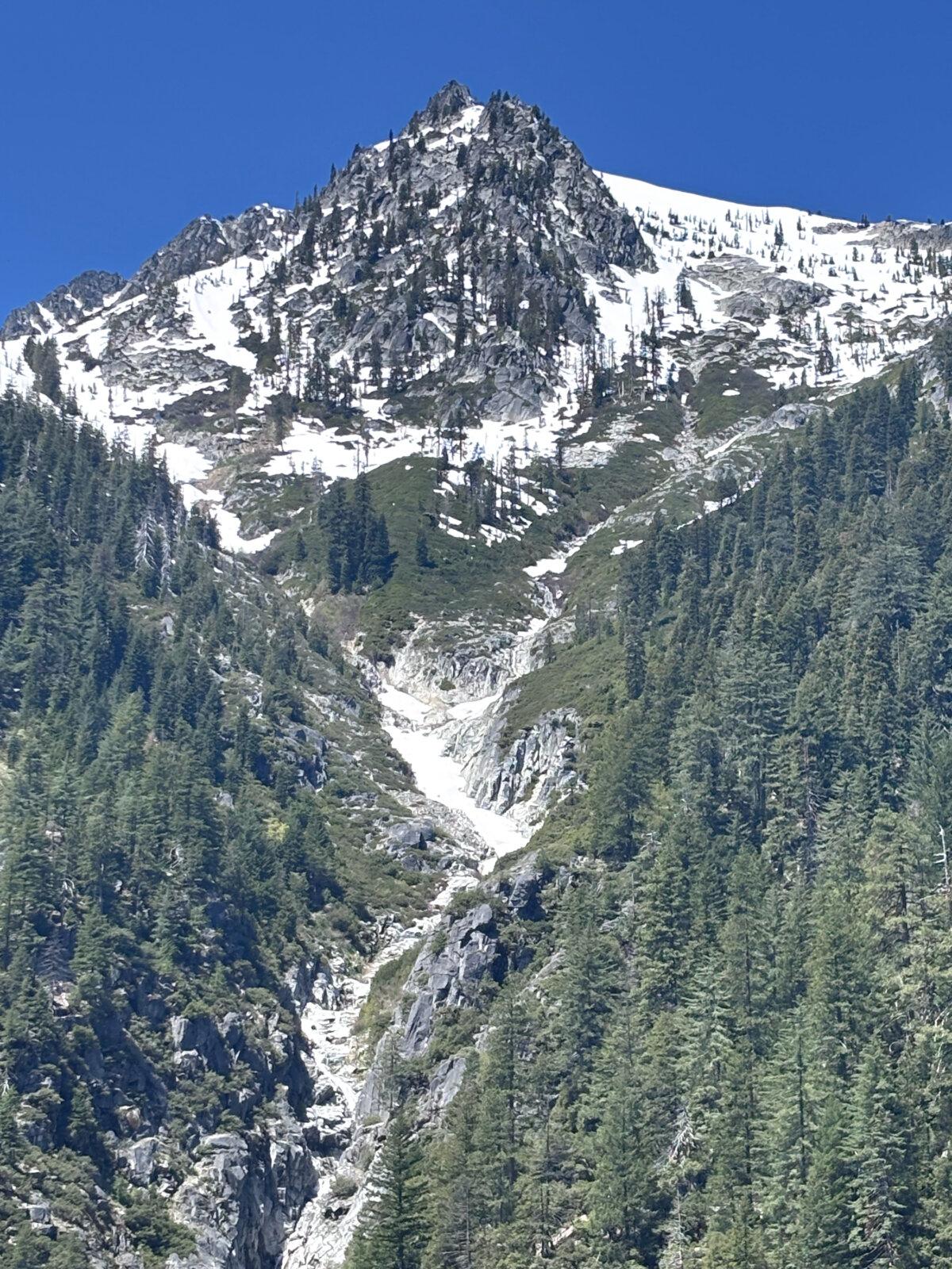
Canyon Creek: The most popular trail in the Trinity Alps, Canyon Creek presents several day-hiking opportunities, including an eight-mile round-trip trek to its wide and roaring lower falls, a 12-mile jaunt to its middle falls or a 15-mile journey to the massive upper canyon falls. The most adventurous of day-trippers can also attempt to reach the Boulder Creek lakes or Canyon Creek lakes, but these are both longer treks and should be considered only with ample planning.Granite Lake via Swift Creek Trail: This is a popular hike in the summer, given Granite Lake is one of the easier alpine lakes to reach. It is a moderate 10.5-mile round-trip hike with almost 2,000 feet of elevation gained. But given this trail’s immense beauty—multiple waterfalls and endless patches of wildflowers—you will be rewarded regardless of how far you trek.
You’ll start at the Swift Creek Trailhead, taking good care not to park in “stock parking” areas, where mule packers and horse riders store their trailers during their treks. You’ll follow along Swift Creek, an awe-inspiring blue beauty, and just under a mile in, hear your first waterfall before you reach it, a luscious wide cascade you can peep from a ledge of the trail. Keep an eye out for California pitcher plant, a native carnivorous plant.
The Swift Creek Trail Bridge is shortly thereafter and brings Swift Creek fully into view. This is a fine turnaround spot if you’d like a leisurely stroll, but even more beauty awaits should you continue. Only two more miles ahead, another massive waterfall awaits, and then not that long after, the lake where backpackers camp on its shore and some fish for trout.
Stoddard Lake: On this 6.6-mile moderate hike, you’ll pass through forests and meadows and have nice views of Mt. Shasta and Billy’s Peak as you head to Stoddard Lake, a 25-acre lake that is 84 feet deep. For hikers who want to extend their journey and check out McDonald Lake, a shallower but pleasant spot, the hike will be 7.7-miles round-trip. The only downside to this incredible hike is that at least the last half mile of the road is too rough for low-clearance vehicles. Best to check the ranger’s station before heading out to ask about road conditions.
Tangle Blue and Big Marshy Lakes: Two hikes are available at this trailhead: an easier 6.6-mile trek along the Grand National Trail to Tangle Blue, a 12-acre lake that’s 17 feet deep, or a 10.9-mile moderate trek that takes you to Big Marshy and Little Marshy Lakes, with an option for a short side trip to spot the Marshy Creek waterfall.
Other Fun Activities
Backpacking: The Trinity Alps are a backpacking paradise, with near limitless opportunities to disperse-camp near a roaring waterfall or a grassy meadow. And if you’d like to save your back or bring a few extra snacks, you can hire a mule team or rent llamas that, after taking an orientation, you will guide along the trail.Fishing: At Trinity Lake, you can rent a deck boat, pontoon boat or houseboat and try your hand at catching large and smallmouth bass, rainbow trout and Kokanee salmon. There is a fly-fishing area below the Lewiston Dam in a “fly stretch” of the Trinity River, according to the forest service.
Shopping: Both downtown Weaverville and Lewiston are home to cute shops selling local wares. Pop into Lewiston Stamps in Weaverville to find great hats and other apparel featuring hand-crafted stamps and drawings by artist Amy McComb. At Moon House: Coffee, Games & Grub, you’ll find not only custom coffees but also a tasty menu that includes vegan options (and maybe even a Magic: The Gathering game you can join). And if you’re not ready to head back to your campground, head into Trinity Theatre to catch the latest movie.
Birding: More than 300 birds migrate through or live in the Trinity Alps, including eagles that roost along the shores of Trinity Lake. Other birds in the area include pygmy owls, belted kingfishers and wild turkey.
White water rafting, kayaking and canoeing: The Trinity River, a 203-mile tributary of the Klamath River, starts in the Trinity Alps and features calm waters and multiple classes of white water. Several local businesses offer rafting trips ranging from a chill kickback to extreme sport opportunities.
The Trinity Alps Wilderness is one of the most beautiful corners of California. It stays that way, in part, because those who have come before you practiced Leave No Trace, a robust yet straightforward set of guidelines. Please ensure that you leave only footprints—not orange peels or more!—and take only photographs and memories. It will ensure that the Trinity Alps are beautiful for the next camper.