Sea Level Rise Along China’s Coast Poses Risk of Geological Disasters

Sea Level Rise Along China’s Coast Poses Risk of Geological Disasters
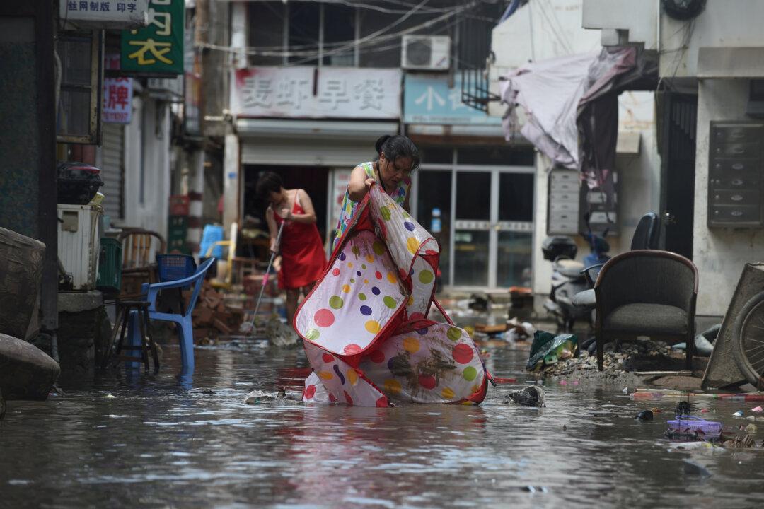
People clean a flooded street after typhoon Lekima hit Linhai City of Taizhou, Zhejiang Province, China on Aug. 11, 2019. (Reuters)
5/3/2021
Updated:
5/3/2021

In recent years, the sea level in China’s coastal areas has continued to rise significantly, which may lead to a variety of geological disasters in coastal areas. At the same time, land subsidence has become increasingly serious, according to a report by Chinese authorities.

According to data from the “2020 China Sea Level Bulletin” (hereinafter referred to as the “Bulletin”), recently released by China’s Ministry of Natural Resources, the sea level along China’s coastal areas rose by 2.87 inches last year when compared with the average level between 1993 and 2011.
Additionally, the sea levels along the entire coastal line are higher than normal, with Tianjin (a major port city in northeastern China) showing the biggest rise—about 3.85 inches higher than the normal range. The Bulletin pointed out that the relative sea level rise in many coastal cities is closely related to the land subsidence from excessive groundwater exploitation and other factors.

Among all coastal provinces and municipalities, sea levels near Hebei, Tianjin, Shanghai and Zhejiang are significantly higher. Compared with the normal range, the sea levels at these locations are 3.46 inches, 3.85 inches, 3.34 inches, and 3.46 inches higher respectively. Compared to the sea levels in 2019, Hebei’s level is 0.35 inches higher, while Tianjin and Shanghai are 0.31 inches higher.

The sea level along the Bohai Sea had the biggest rise last year, almost 3.5 inches higher than usual. Compared with 2019, the Bulletin noted the sea level along the coast of China showed a characteristic of “rising in the north and falling in the south,” as the Bohai Sea and the Yellow Sea in the north both rose by around 0.47 inches, the East China Sea and the South China Sea in the south both fell by around 0.35 inches.

Since 1993, China’s coastal sea level has been rising in a fluctuating pattern at a rate of 0.15 inches per year, which is higher than the global average of 0.13 inches per year during the same period.

More Than 120 Cities Experienced Land Subsidence

According to the report “Current Land Subsidence Map,” released by Chinese authorities in 2019, by the end of 2015, land subsidence had occurred in 102 cities in 21 provinces in China, which was double the figures at the end of 2010.

According to the Bulletin, Chinese scientists believe that land subsidence had also contributed to the rise of sea levels along the coast. Coastal cities such as Tianjin, Shanghai, and Guangzhou are located on silted plains at the mouth of big rivers, and the ground is soft. Over-extraction of ground water and the weight from large-sized buildings have jointly led to land subsidence. A study in 2019 showed that the average land subsidence in Tianjin’s Binhai New Area was around 0.55 inches, and the average subsidence in Shanghai was about 0.20 inches.

Public data revealed that the land subsidence rate in Tianjin was as high as 3.93 inches per year in the early 1980s.

Time magazine reported in 2012 that Shanghai’s urban area descended more than 6 feet since 1921.

Sea Level Rise Causes Geological Disasters

According to a 2017 report by the China Geological Survey, the accelerated rise of sea levels can directly lead to the inundation of lowlands, land loss, intensified and more frequent typhoons and rainfall, aggravated storm surges, coastal erosion, floods, and mudslides. In addition, it will cause a series of problems such as waterlogging at estuaries, seawater intrusion, soil salinization, and wetland ecosystem degradation.

Data indicated that in 2014, saltwater intrusions occurred eight times around the Pearl River Estuary, with the longest one lasting for 15 days. The coastal areas of Liaoning, Hebei, Tianjin, and Shandong had experienced severe soil salinization due to rising sea levels.

At the same time, 70 percent of China’s sandy coasts have been eroded and receded, some of which receded several meters or even tens of meters every year. A few examples are: the 919-feet-long shore section near the Tuyang Toll Station of the Shenzhen-Huizhou Coastal Expressway was seriously eroded, with an average erosion width of 31.2 feet; a basketball court built on the seaside completely disappeared; the Longhu Bay shoreline in Chaoyang District, Shantou was seriously eroded, leading to the partial collapse of dams and severe damage to the buildings along the coast. Some houses had corners hollowed out from the erosion.

Moreover, the Bulletin estimated that Typhoon Lekima in August 2019 caused an economic loss of $5.95 billion to Zhejiang Province, and Typhoon Hagupit in August 2020 caused a loss of $1.13 billion.

The official report “China Marine Disaster Bulletin,” published on April 26, 2020, also confirmed that the high sea level along China’s coast last year has exacerbated storm surges and floods in coastal cities, leading to a total direct economic loss of $130 million. Zhejiang and Guangdong were the worst hit areas.

According to a 2019 study by the U.S. research institute Climate Center, rising sea level could threaten 93 million residents in China by 2050.

If Shanghai encounters floods or seawater intrusion 30 years from now, the entire city could become a disaster-affected area, according to the 2019 land subisdence report. Jiangsu Province, the Pearl River Delta region, and parts of Hong Kong and Macau will also be threatened by floods, the study revealed.

China Marine Disaster Bulletin warned that July and August this year is the seasonal high sea level period in coastal Hebei, and Tianjin will enter the astronomical tide period during this time frame. August to October is the seasonal high sea level period in coastal areas in Shanghai, while Zhejiang will enter the astronomical tide period. All these areas may experience worsened flooding disasters from increased storm surges.