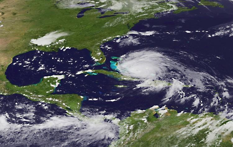
Hurricane Irene May Hit Carolinas, NortheastIrene became a Category 3 hurricane and took aim at the North Carolina Outer Banks and New England this weekend, sparing Florida and Georgia.SavePrintMarie Yeung8/24/2011|Updated: 10/1/2015We had a problem loading this article. Please enable javascript or use a different browser. If the issue persists, please visit our help center.Share this articleLeave a commentMarie YeungAuthorAuthor’s Selected ArticlesMammoth Power Grids at Risk of Failure?Apr 25, 2014April Is Autism Awareness MonthApr 05, 2014Weather Conditions Endanger Food SuppliesMar 23, 2014Announcing the 52nd Annual National Poison Prevention WeekMar 18, 2014Related TopicsUnited StatesNortheast
")


