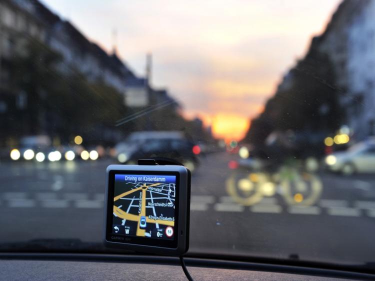

BOSTON—With the onset of GPS units in our vehicles and in our smartphones, most of us take advantage of Global Positioning System technology every day without knowing its complexity, its many applications, and the global collaboration needed for GPS technology.
Dr. John W. Betz, a fellow of the MITRE Corporation, and chairman of the U.S. Air Force Scientific Advisory Board, spoke Nov. 10, at Northeastern University in Boston on the advances of satellite-based navigation. Betz talked about the uses of GPS, the technology behind it and the cooperation between countries around the world.
The United States developed GPS technology, and the U.S. system is run by the United States Air Force and is managed by joint civilian and military leadership. For a country to run a full satellite system requires a yearly investment of $US1 billion and at least 24 satellites in orbit around earth.
The United States provides the signal to the world free of charge. President Reagan, after a Korean plane went astray and was shot down over Russia after losing its navigational system, gave GPS to the world to use free of charge. According to Beltz, the United States will continue to provide GPS to the world for free.
The challenge with GPS technology is the coordination of GPS satellites and frequencies around the world.
The European Union (Called Galileo), Russia (Called GLONASS), China, (Called COMPASS), India, (Called IRNSS), Japan (Called QZSS) also have GPS systems in place. With limited bandwidth available for the optimum use of satellites, diplomacy is underway among satellite enabled nations to best coordinate their signals and collaborate on the technology.
According to Betz, the picture of GPS will look very different 10 years from now, and great opportunities will come using the world infrastructure, for both research and for business.
GPS is not just used in transportation. Its applications are also used for precision agriculture. GPS enables farmers to drive tractors within a few centimeters of accuracy to sow fields, and measure water, fertilizer, and crop yields. It is also used in timing applications, such as those used in financial transactions where automatic trading requires buy and sell timing, thus GPS technology allows for accurate time stamps in such transactions.
GPS works where any four of the many satellites, which are synced with an atomic clock, send signals down to earth. The signals are read by a receiver that calculates the distance and time of each clock. Once the receiver knows the delay, it knows its distance from each satellite, which gives the exact location of the receiver.
Betz said that GPS provides information within a few meters of accuracy, and that contrary to belief, one thing it does not tell you is where you are on a map. It is the mapping software and the receiver that calculate the coordinates and interpret them to navigation software. Betz said GPS does not work well indoors since the power of the signal is less than that of an average home light bulb being sent down from space 10,000 miles or more away.
He also said contrary to what many believe, GPS has no idea where you are. The GPS satellites only send signals. They do not get signals back from your device. It is only your receiver that can interpret the signals and provide information on where you actually are. The satellites cannot know.