Australia’s Top End On Cyclone Alert

Australia’s Top End On Cyclone Alert
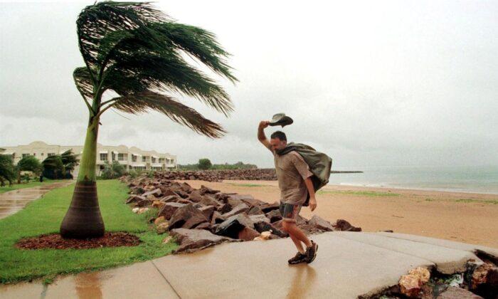
In this picture a man pushes against a cyclonic wind in Darwin on 08 December, 1998. (DAVID HANCOCK/AFP via Getty Images)
Steve Milne
2/25/2022
Updated:
2/25/2022

Cyclone warnings have been issued for The Top End of Australia’s Northern Territory (NT) and the Kimberly region of Western Australia as a tropical low pressure system intensifies to the west of Darwin.

The Bureau of Meteorology (BOM) has been monitoring a mass of clouds over the Timor Sea around 320km west of Darwin, which has drawn moisture from Indonesia over the past 24 hours.

This, in addition to sea surface temperatures of around 30 degrees Celsius, is providing fuel for the weather system to intensify.

BOM has issued a warning of gales up to 100 kilometres (62 miles) per hour developing in western parts of the Tiwi Islands by Friday night and potentially extending between Point Stuart, east of Darwin and Wadeye, not far from the Western Australian border, on Saturday.

Darwin is included in areas under the cyclone watch.

In addition, heavy rainfall may lash the Tiwi Islands and western parts of the Daly district on Friday and continue through Saturday as the low intensifies.

If the system tracks more to the southwest, heavy rainfall is also likely over the northern parts of the Kimberly region on Saturday.

The latest track map shows that the slow-moving weather system will reach category one strength by Friday night or Saturday morning but potentially intensify to a category two storm by Sunday.

BOM meteorologist Jonathon How said tropical lows that form above the Northern Territory and Western Australia are often erratic as they interact with the coastline.
He added that the bureau is consulting both the Australian and European computer weather models of this low pressure system to be more accurate in forecasting. While both models agree on the likely behaviour of the storm through Friday, but into the weekend, they diverge, and by Sunday, the European model places the centre of the low over the Top End of the NT, whereas the Australian model positions it over the Joseph Bonaparte Gulf to the southwest of Darwin.

“So, keeping this in mind, the total forecast of rainfall does depend on how this low or cyclone does move,” How said.

“But we are expecting heavy falls for parts of the Top End and parts of the Kimberly as well.”
Steve is an Australian reporter based in Sydney covering sport, the arts, and politics. He is an experienced English teacher, qualified nutritionist, sports enthusiast, and amateur musician. Contact him at [email protected].
twitter
Related Topics