Severe thunderstorms passing across the greater Lake Michigan area on July 27 birthed a devastating tornado 0.85 miles wide just after midday that devastated communities in Wisconsin between Appleton and Lake Winnebago, according to an initial damage report from the National Weather Service.
Footage of what appeared to be a large tornado touching down outside Appleton, Wisconsin, and the damage left in its wake was widely reported by individual storm chasers and mainstream media as the devastating cluster of thunderstorms marched southeast from the upper Midwest, down and around the shoreline of Lake Michigan through the Chicago metro area, and impacting Michigan and Indiana.
A tornado’s intensity is graded by the Enhanced Fujita (EF) scale, which runs from EF-0 to EF-5. Each rating is generally characterized by the wind speeds the tornado generates, with an EF-0 producing winds of 65-85 mph and an EF-5 boasting winds more than 200 mph. Ultimately, though, the EF scale is determined by the amount of destruction a tornado causes.
Storm chasers on-scene almost immediately estimated this Appleton tornado to be an EF-3, generating winds between 136-165 mph, and the National Weather Service’s office in Green Bay confirmed their sightings and estimate in its initial report the following day, deeming the damage found to be consistent with EF-3 damage.
An official damage survey team determined that a tornado touched down in Appleton just before 1 p.m. ET and moved south, covering a little more than 12 miles across Winnebago County, and passing through the town of Menasha before dissipating over Lake Winnebago around 1:22 p.m.
Winds neared 140 mph, and the funnel’s maximum width was determined to be 1,500 yards across, which is a little more than 0.85 miles.
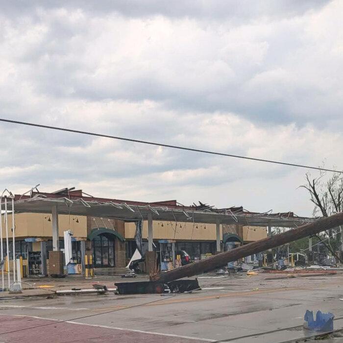
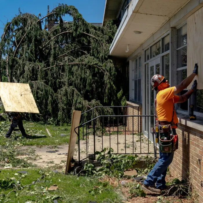
“The tornado snapped and uprooted numerous trees and produced damage to several area homes and businesses along its path,” the report stated. “The worst damage occurred in the Fox Crossing and Menasha areas, where several businesses were heavily damaged near Highway 10 and a house destroyed in Menasha.”
As of 12:30 p.m. on July 28, no injuries or deaths caused by the tornado had been reported.
Other tornadoes were also reported throughout the extreme weather event in parts of Illinois and Indiana. Initial storm reports out of the National Weather Service’s office in Chicago accounted for three reported tornadoes on the outskirts of the Chicago metro area.
The first was from Glen Ellyn, Illinois, just before 1 p.m., where photos of a tornado near the location of a radar-indicated tornado signature were passed along to the National Weather Service. The second came from Orland Park, Illinois, around 1:45 p.m., and the third came out of Hazel Crest, Illinois, just before 2 p.m.
A fourth tornado was reported at 7:14 p.m. in Hoopeston, Illinois, near the Indiana state line, after video captured a tornado briefly touching down one mile west of IL-1.
By 4 p.m. on July 28, the National Weather Service office in Chicago was able to confirm two tornadoes: one EF-1 tornado in Lansing, Illinois, and one EF-0 tornado in Glen Ellyn, Illinois.