Rainfall records have been smashed after heavy storms lashed Victoria, with New South Wales (NSW) now on high alert for a spate of destructive weather.
The Bureau of Meteorology warned heavy and intense rain is anticipated for NSW residents from April 4, exceeding 100mm with totals close to 200mm.
People living in New England, Northern Rivers and the northern half of the mid-north coast face widespread showers of 30 to 50mm, and some parts could experience up to 100mm.
Heavy and intense rainfall, flash flooding, strong gale-force winds and hazardous surf conditions could arrive on the mid-north coast on Friday moving to the Hunter, Sydney, Blue Mountains and Illawarra.
The heavy conditions are expected to shift to the Illawarra and South Coast on Saturday.
NSW SES Assistant Commissioner Sean Keans urged east coast, Blue Mountains and metropolitan Sydney communities to prepare by cleaning gutters, trimming trees and securing loose items around their homes.
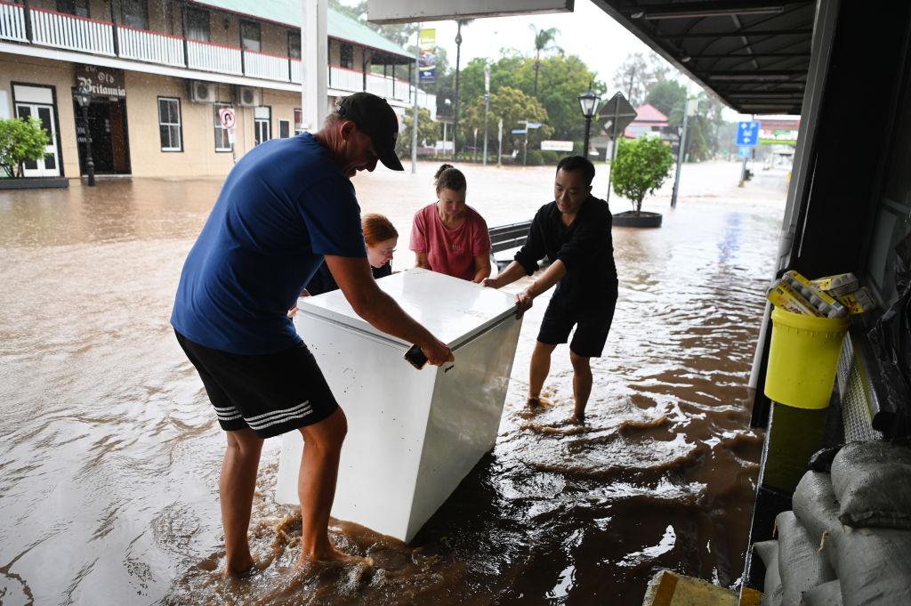
“Flood and storms teams are on standby to respond should they be required, but we’re pleading with the community to be prepared, stay informed and not drive through floodwaters,” he said.
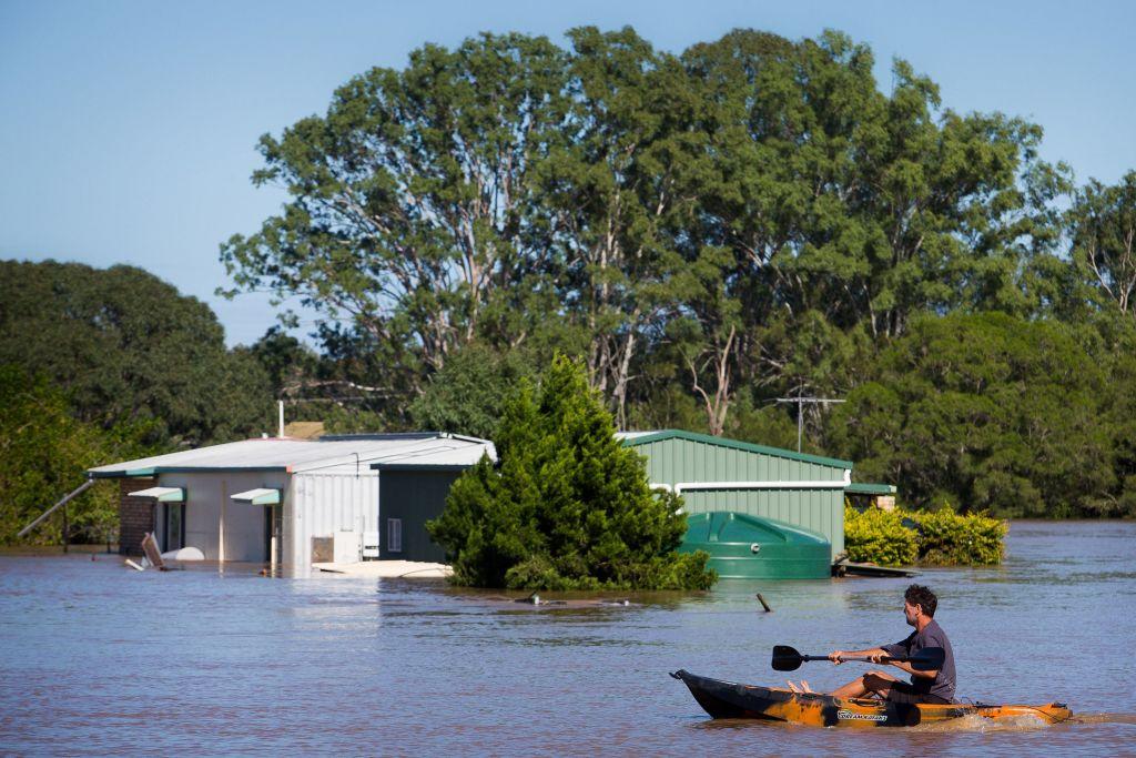
The warning comes after Melbourne was hit by the equivalent of one month’s rain on April 1, while some parts of Victoria recorded rainfall not seen for more than 150 years.
More than 500 calls have been made to emergency services with 267 reports of building damage and 117 flood-related incidents across the state in the 24 hours to 8am, the SES said on April 2.
One of the worst incidents involved a woman who could have drowned in the central Victorian town of Daylesford.
The 58-year-old fell down an embankment and into a stormwater drain on Monday night.
She was carried by fast-flowing water until grabbing hold of a metal pole but her cries for help could not be heard over the sound of rushing water, Victoria Police said.
The woman suffered minor cuts and bruises but was eventually able to climb out and seek help from a friend.
There had been four separate flood rescues since midday on Monday, SES duty officer Erin Mason said.
“Mainly it’s been people driving through floodwater,” she said.
“If the road is flooded, I encourage people to stop, turn around and find an alternate path.”
Areas hardest hit included suburbs in Melbourne’s outer east and west, as well as parts of Geelong.
A severe weather warning for eastern Victoria and parts of southern NSW was cancelled by Tuesday afternoon, April 2.
On April 1, lightning caused a 40-minute halt to the Geelong and Hawthorn AFL match at the MCG in inner Melbourne while the Stawell Gift finals were delayed by about two hours due to torrential rain and water over the track.
Lightning strikes twice forced staff working on the tarmac at Melbourne Airport to move to a safe area.
The highest rainfall totals were in central Victoria, while Olympic Park in Melbourne recorded 53mm—more than the city’s average rainfall total for the entire month of April.
However, the downpour was not expected to cause river flooding, the BOM’s Lincoln Trainor said.
“Catchments were so dry that it did not cause any river rises ... it just got absorbed by that really parched, dry ground,” the senior meteorologist said.
The wet weather also shattered several long-held daily rainfall records.
Falls in Mornington totalled 65.2mm, the highest daily April rainfall in 157 years.
Wonthaggi in Gippsland received 64.4mm, breaking a record set 114 years ago.
The 92mm at Upper Plenty in Melbourne’s northeast was the highest ever recorded at that station.