Communities Still in the Dark After Destructive Storms in Queensland

The bureau said the system was a 40 percent chance of becoming a cyclone on Feb. 16.
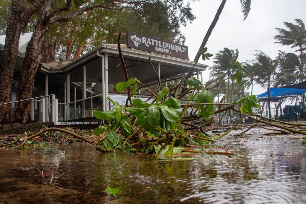
Communities Still in the Dark After Destructive Storms in Queensland
A bar restaurant is seen past fallen branches in Palm Cove as Cyclone Jasper approaches landfall near Cairns in far north Queensland on December 13, 2023. A tropical cyclone was building strength as it rolled towards northeastern Australia on 13 December, with authorities warning "life-threatening" floods could swamp coastal regions for days. Photo by Brian Cassey/AFP via Getty Images
AAP
By AAP
Updated:
0:00

A third cyclone in as many months may be looming, with flood-hit regions bracing for gale-force winds and heavy rain.

A slow-moving tropical low in the Gulf of Carpentaria prompted a cyclone watch to be issued by the Bureau of Meteorology late on Feb. 14.

Winds up to 100km/h and isolated falls of 200mm may hit the Gulf’s southern coast over the coming days.

The low is considered a moderate chance of strengthening into a tropical cyclone as early as Thursday night, Feb. 15.

The cyclone watch area currently spans from the Northern Territory’s Port Roper to Burketown in Queensland’s northwest.

The bureau said the system was a 40 percent chance of becoming a cyclone on Feb. 16.

“We do expect with the favourable conditions in the Gulf of Carpentaria that that system could develop into a tropical cyclone,” a bureau spokesperson said.

It would be the third cyclone of the season to impact Queensland.

The Gulf region is already reeling from flooding caused by ex-cyclone Kirrily which crossed the Queensland coast just weeks ago before lingering in the northwest.

In mid-December, Tropical Cyclone Jasper caused record flooding and forced a community to evacuate when it made landfall as a category two system north of Cairns.

Even if the low doesn’t develop into a cyclone, the Gulf’s coastal areas are still set to be lashed by strong winds and heavy rainfall with the system forecast to track west back toward central NT.

There has already been widespread rainfalls of up to 100mm in the NT’s northwest over the last three days.

In Queensland, the inundated Gulf region has been further hit by heavy falls with Georgetown copping 100mm and Burketown more than 70mm in the last 24 hours.

“There is a risk of severe weather happening regardless of whether it develops into a tropical cyclone,” the bureau spokesperson said.

“In Queensland this may further exacerbate flooding that is already occurring.”

People in the watch zone have been urged to be prepared and keep up to date with alerts.

In Queensland, the system looks set to add to an already long list of recent natural disasters that have blown the state’s repair bill beyond $1 billion (US$650 million)

Hardship payments are still being made available in the wake of Kirrily, with primary producers in 15 local government areas now able to apply for loans up to $250,000.

Overall 32 local governments across the state have been activated for recovery assistance.

In the far north, the clean-up is still continuing in the wake of Cyclone Jasper with Queensland Rail crews working hard to reinstate services.

The popular Kuranda Scenic Railway is set to resume on Feb. 17 but further works to “future proof” the track is expected to continue through to July 2024.

Queensland’s tourism industry is also trying to recover with Virgin Australia releasing more than 300,000 sale fares over seven days from Feb. 14.

Tourism and Events Queensland is also offering more than 500 deals on accommodation, attractions and experiences.