The shores of Lake Michigan were slammed by severe thunderstorms that birthed damaging tornadoes, large hail, and wind gusts reaching hurricane speeds in the middle of the day on July 27.
A cluster of extreme weather was moving east-southeast, scraping across the shoreline from Green Bay, Wisconsin, through Chicago, Illinois, and stretching across the lake to Michigan’s western shore and inland from Traverse City to Grand Rapids. Northern reaches of Indiana, including South Bend to Fort Wayne, were also impacted.
The Weather Prediction Center also warned, “A supercell located over northeast Illinois will develop south/southeast across the southern greater Chicago metro vicinity” around 1:30 p.m. ET.
Meteorologist Reed Timmer caught at least one tornado on the ground around Appleton, Wisconsin, causing severe damage to the surrounding areas of Lake Winnebago, according to footage posted on X.
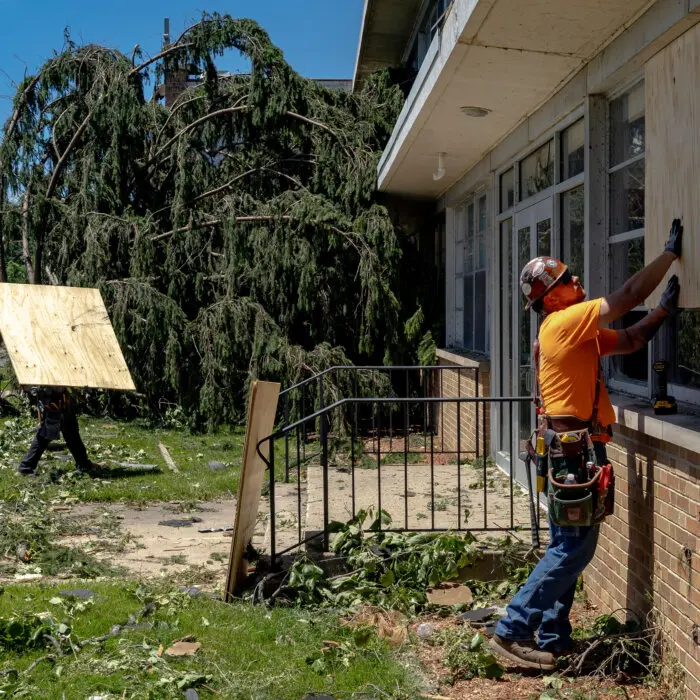
Videos posted on social media showed uprooted trees, downed power lines, and destroyed property from the Appleton Metro Area, especially in the towns of Menasha and Neenah. An estimated casualty count has not been released.
A tornado warning was also issued for areas south of there, including around Fond du Lac, warning of tennis ball-sized hail, as well as for northwestern parts of Indiana.

Meteorologist Max Schuster reported tornadoes in Orland Park, Illinois, and around Lansing, Illinois, crossing the state line into Indiana, in posts on X.
An official tally of the number of tornadoes produced by this event won’t be confirmed by the National Weather Service until the storm has passed and its team can assess the damage.
“I have been briefed on the storms making their way through Wisconsin,” the state’s governor, Tony Evers, said in a statement on X. “The state is ready to assist communities however we can. I also want to thank the emergency responders who are hitting the ground to help. As storms continue, stay alert and stay safe, Wisconsin.”
As the storm cluster moved southeast and passed over the Second City and into Indiana through the rest of the early afternoon, severe thunderstorm and tornado warnings followed. Radar systems also continued to highlight an ongoing barrage of lightning strikes.
The Weather Prediction Center warned of wind gusts in excess of 60–80 mph, large hail, and a possibility of tornadoes developing.
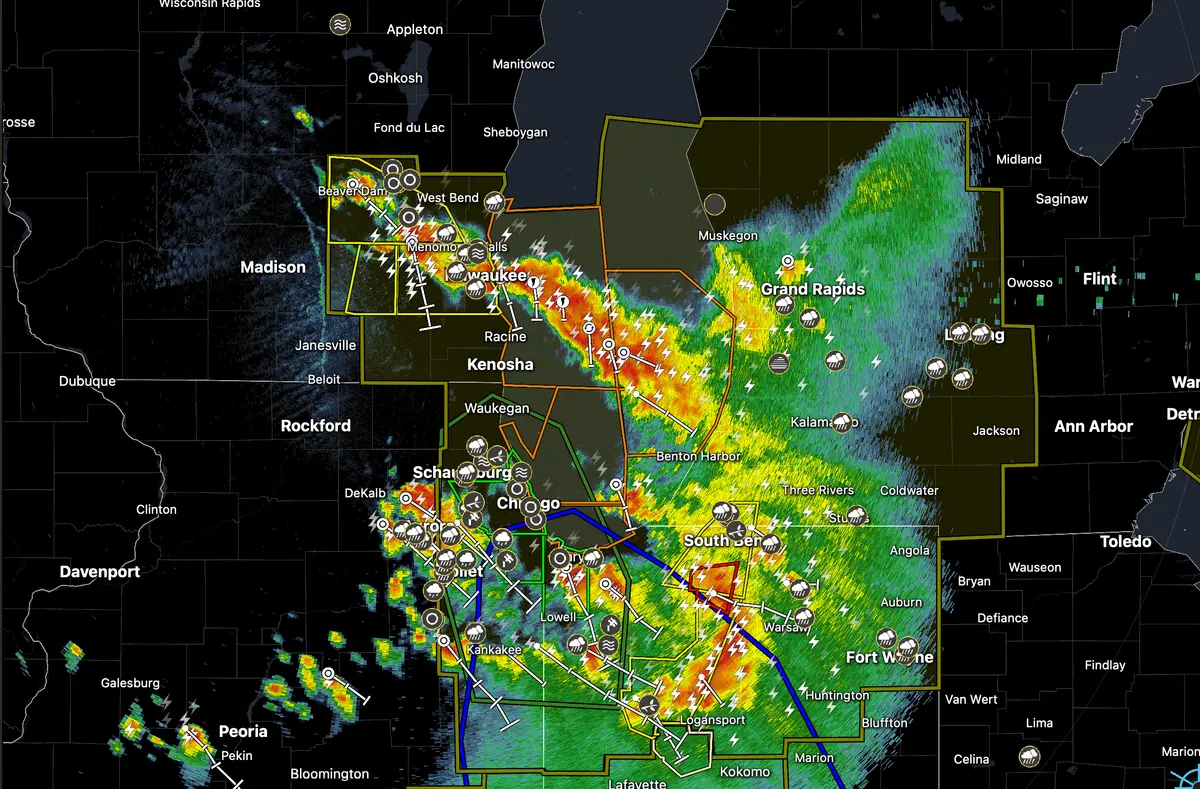
Flash flood warnings were also issued for parts of Cook County and other areas of northern Illinois that were set to last through 6 p.m. ET as the National Weather Service warned this thunderstorm was producing a deluge dumping 1–2 inches of rainfall per hour.
Reports from citizens on the ground to the RadarScope app included flooded streets, downed tree limbs, hail of various sizes, substantial roof damage, and even a mudslide across the region.
Special marine warnings were also issued across vast swathes of nearshore and open water areas of Lake Michigan, warning of high seas, strong winds, damaging hail, and mesocyclones capable of generating waterspouts.
“Boaters should seek safe harbor immediately until this storm passes,” one warning declared. “Wind gusts 34 knots or greater, large hail, high waves, dangerous lightning, and heavy rain are possible with this storm.”
By 3:30 p.m. ET on July 27, almost 300,000 customers in Illinois were without power, including nearly 163,000 in Cook County alone, as well as more than 81,000 customers in Wisconsin and more than 25,000 in Indiana.