New York City, Boston, Philadelphia, and other cities and towns across the northeast saw temperatures break 100 degrees on June 24 as a heat wave continues to impact the region throughout the last few days following the Summer Solstice.
New York’s John F. Kennedy Airport recorded that triple-digit temperature for the first time since 2013, Philadelphia, and Boston recorded the same shortly afterward. And 100-degree temperatures were even felt in Maine.
The day before, nearly 40 heat records were either reached or tied.
“Heat advisories are in effect for portions of the Midwest, South, Southeast, and East Coast, and extreme heat warnings are in effect for portions of the Ohio Valley and Mid-Atlantic,” the Weather Service’s Weather Prediction Center said on June 25.
“Extreme heat will linger in the Ohio Valley through the end of the work week, with high temperatures in the 90s and lows in the 70s each day, but temperatures elsewhere should begin to moderate by Thursday night.”

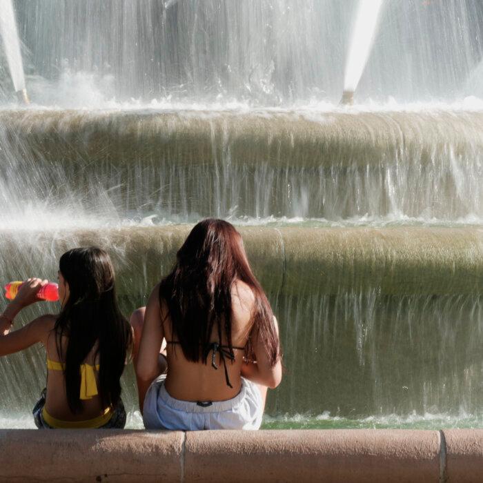
The Weather Prediction Center also warned that the heat could be dangerous to anyone who does not remain adequately hydrated and maintain effective cooling. Long-duration exposure can lead to heat-related illnesses such as heat exhaustion and heat stroke.
Storms can also come with the summer heat.
“With extremely warm, moist, unstable air in place across most of the Central and Eastern U.S., some thunderstorm activity may become severe,” the Weather Prediction Center stated.
“Scattered severe thunderstorms with damaging winds are expected to develop this evening across the Southwest, Plains, and Upper Midwest.”
“This level of rare and/or long-duration extreme heat with little to no overnight relief affects anyone without effective cooling and/or adequate hydration,” it stated on the website. “Impacts likely in most health systems, heat-sensitive industries, and infrastructure.”
A wider area was warned by the NWS to prepare for a “major risk” of heat-related impacts.
Daytime summer temperatures in the United States have increased by approximately 2.2 degrees Fahrenheit since 1970, according to data from the National Oceanic and Atmospheric Administration. The nighttime temperatures have increased even more, averaging 2.6 degrees Fahrenheit higher since that same year, impacted to some degree by increased humidity and urban heat retention, among other factors.
That nighttime temperature now, kept high by enduring humidity, has made the heatwave even worse.
“You get the combination of the extreme heat and humidity but no relief,” said Jacob Asherman, a meteorologist at NOAA’s Weather Prediction Center. “It’s kind of been just everything stacked on top of itself ... It just speaks to how strong this heat wave is. This is a pretty, pretty extreme event.”