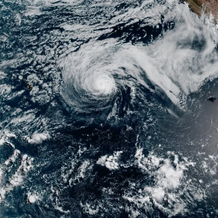
In less than 48 hours, a tropical storm exploded into the first Category 5 hurricane recorded in the Pacific in two years.
Hurricane Genevieve reached the highest intensity level in the early morning hours of July 27, according to the National Hurricane Center, with maximum sustained winds reaching 160 mph and even stronger gusts.
It reached hurricane status just after midnight ET on July 26.
Hurricane-force winds (74 mph and greater) extend 45 miles from its center, and tropical storm-force winds (39 mph–73 mph) stretch out 195 miles.
The eye of the storm was clocked 530 miles south-southwest of the southern tip of Baja California, Mexico, and appears to be heading further out to sea, moving northwest at 13 mph.
“Swells generated by Genevieve are affecting portions of the southwestern coast of Mexico and southern portions of the Baja California Peninsula, and will spread northward along the remainder of the west coast of the Baja California Peninsula by tonight,” the National Hurricane Center (NHC) warned.
“These swells are likely to cause life-threatening surf and rip current conditions.”
However, as of early on July 27, no coastal watches or warnings were issued.
Genevieve is the first Category 5 hurricane to appear in the eastern Pacific since Hurricane Kristy, which had maximum sustained winds of around 161 mph (140 knots) on Oct. 24, 2024.
However, like Kristy, Genevieve was not expected to make landfall, nor was it expected to retain its Category 5 status for long.
The hurricane center announced it weakened to a Category 4 by 11 a.m. on July 27, but was still expected to retain its major hurricane status (Category 3 and above) through July 28 as it continued a push northwest, remaining clear of Mexico, California, and the Hawaiian Islands.
While the tropical cyclones that impact Japan, the Philippines, China, and Taiwan in the western Pacific are called typhoons, those that form near Mexico, California, and Hawaii are still called hurricanes.
And Genevieve is not the only hurricane in the Pacific.
Hurricane Fausto is churning further west at about 14 mph with maximum sustained winds of 80 mph.
On July 27, its center was tagged 580 miles east of Hilo, Hawaii, with hurricane-force winds extending 35 miles and tropical storm-force winds up to 140 miles out.
Fausto is expected to weaken to a tropical storm before the end of the day, and diminish to a tropical depression by the time it moves west of Hawaii on July 30.
However, the National Hurricane Center warns it would still produce a significant life-threatening surf event for the islands throughout the week.
“Surf generated by Fausto will continue to build westward across Hawaii along exposed east-facing shores through Tuesday [July 28] as Fausto approaches and begins to pass north of the islands,” the hurricane center said on July 27.
“Large surf and strong currents will lead to dangerous conditions along exposed shores.”
The National Weather Service office in Honolulu has issued high surf advisories for large, northeast-facing swathes of coastline for the Big Island, Oahu, Molokai, Maui, and Kauai, with tropical storm warnings predicting seas upwards of 16 and 17 feet issued for waters 40 nautical miles to 240 nautical miles offshore.