


An air-borne science laboratory began flying over the skies of Ontario, Canada, this week as part of NASA’s experiments ahead of the launch of its precipitation measurement satellite mission in 2014.
The experiments will help scientists match snow measurements in the air and on the ground with the satellite’s measurements.
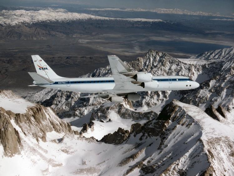
With help from Environment Canada, NASA is using its new radar technology aboard a DC-8 plane to measure snow fall in Ontario from Jan. 17 to Feb. 29. The instruments simulate the measurements that will be taken by the space agency’s Global Precipitation Measurement (GPM) satellite mission.
“The DC-8 gives us essentially what the satellites do see, it has the remote sensing instruments like a satellite uses,” said Gail Skofronick-Jackson, the deputy mission scientist for the GPM mission.
After its launch, the GPM satellite will be providing worldwide rain and snow observations every three hours. The mission sets a new standard for precipitation measurements from space and marks a first for detecting snow fall from space.
While satellites have been able to estimate rain precipitation from space for many years, the technology has been behind in detecting snow from space, explained Skofronick-Jackson.
The field experiment in Canada is meant to improve the satellite’s capabilities to measure snow fall and test the ground validation capabilities.
As part of the experiment, the NASA DC-8 will fly above the clouds, simulating what the satellite would see, while two other aircrafts will fly through the clouds.
“What happens is that you get a 3-dimensional view of the cloud, and that way we can improve our models, we can improve our algorithms, because we know a relationship between what the aircraft sees remotely and what the DC-8 sees remotely from the radar, and what you see directly in the cloud itself,” Skofronick-Jackson said.
One of the goals of the GPM mission, Skofronick-Jackson said, is to integrate the measurements into useful applications and to utilize them to benefit the society.
“We have a field campaign planned, we’re looking at 2013, 2014, for more of these integrated applications studies, so we would take measurements over a particular stream basin and see how the rain flows through, and can we validate those measurements from space, as well as from ground,” she said.


