")
Chile was hit by a strong earthquake measuring 7.1 on the Richter scale on Sunday, according to the U.S. Geological Survey (USGS).
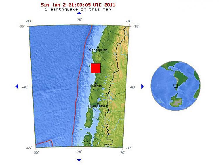
The earthquake hit at 20:20 UTC time, or 5:20 p.m. local (Santiago) time. Its epicenter was 370 miles (595 km) south-south-west of Chile’s capital Santiago, or 45 miles (70 km) northwest of the city of Temuco, at a depth of 10.5 miles (16.9 km).
The National Oceanic and Atmospheric Administration’s West Coast and Alaska Tsunami Warning Center said the quake wouldn’t have a significant impact on North America’s Pacific coast.
“A damaging tsunami IS NOT expected along the California, Oregon, Washington, British Columbia, and Alaska coasts,” an advisory from the center read. “At coastal locations which have experienced strong ground shaking, local tsunamis are possible due to underwater landslides.”
The Pacific Tsunami Warning Center has stated that it expects “no tsunami threat to Hawaii.”
A massive 8.8 magnitude earthquake hit Chile last February, prompting then-Chilean President Michele Bachelet to describe the region as being in a “state of catastrophe.”