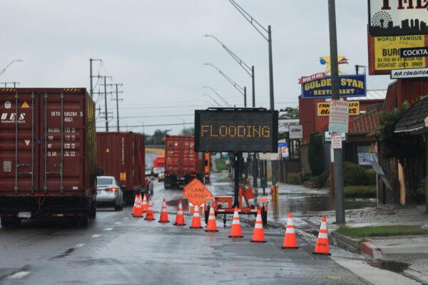
LOS ANGELES—Rain battered Southern California Feb. 1 as the first—and smaller —of two anticipated storms arrived in the region and flooded multiple streets during the morning rush hour, making the commute a nightmare for thousands of Angelenos.
A flash flood warning was issued around 8:30 a.m. for much of the South Bay area, including Torrance, Carson, Harbor City, Long Beach, Palos Verdes, and the Port of Los Angeles. Forecasters said rain was falling in that area at rates between 1 and 1.5 inches per hour, dramatically raising the risk of flooding. The warning will be in place until about 11 a.m.
Flooding shut down the southbound side of the McClure Tunnel in Santa Monica that connects Pacific Coast Highway with the 10 Freeway. The westbound Balboa Boulevard on-ramp on the Ronald Reagan (118) Freeway was closed because of flooding. Rocks were also reported blocking parts of Malibu Canyon Road.
More flooding was reported on the Long Beach (710) Freeway in Long Beach. Multiple vehicles became inundated at a railroad underpass in Long Beach, leaving only the rooftops of the cars visible above the flood.
Long Beach and Palos Verdes Estates officials both issued alerts warning residents about multiple flooded streets.
In Orange County, parts of Pacific Coast Highway in Huntington Beach between Seapoint Street and Warner Avenue were closed in both directions because of flooding. The National Weather Service (NWS) issued a flood advisory until 11 a.m. for Orange County in response to heavy downpours that forecasters said could prompt flooding in cities such as Anaheim, Santa Ana, Irvine, Huntington Beach, Garden Grove, Orange, Fullerton, Costa Mesa, Tustin, and Yorba Linda.

Early Thursday morning, Orange County firefighters made a swift water rescue of a man trapped in a flood-control channel on Sunflower Avenue near Fairview Road, Orange County Fire Authority Capt. Thanh Nguyen said.
The man was “quickly trapped by water and started yelling for help and fortunately a passerby heard yelling and called 911,” Mr. Nguyen said.
Firefighters in the area rushed to the man and were able to get him out and take him to a local hospital to be treated for injuries that were not considered life-threatening, Mr. Nguyen said.
Slippery conditions caused cars to spin out on freeways in Los Angeles and Orange counties, resulting in various lane and road closures. The California Highway Patrol reported at least 50 spinouts and crashes on freeways and roads in the central Los Angeles area Thursday morning.
Despite the dramatic impacts of the overnight and early morning rain, forecasters said the region was actually getting a bit of a break thanks to the speed at which the storm system was moving through the area.
“The front is moving along at a decent clip and this will minimize the flash flooding threat—still advisory level flooding is almost certain in and around the front,” forecasters wrote in a statement early Thursday morning.
“When the front exits the eastern edge of L.A. County around noon, the steady rain will turn to showers and the amount of rain will decrease,” according to the NWS. “The front will bring about 2 inches of rain to most of the coasts and valleys. The south slopes south of Point Conception will likely see 3 to 5 inches of rain.”
As of 4 a.m. Thursday, there was 0.94 inches of rain reported at Leo Carrillo, 0.74 inches in Agoura Hills, 0.37 inches in Calabasas, 0.28 inches in Newhall, and 0.43 inches in Hungry Valley.
Forecasters noted that while the steady rain will turn to showers Thursday afternoon, there will still be a 10–20 percent chance of isolated thunderstorms that “could produce rain rates in excess of 1 inch per hour.”

A winter storm warning will be in effect until 10 p.m. Thursday in the eastern San Gabriel Mountains, including Mount Wilson, Mount Baldy, Wrightwood, and the Angeles Crest Highway. As much as 18 inches of snow could fall above 7,000 feet in the area, with 6 inches possible at 6,000 feet and 3 inches at elevations as low as 4,500 feet. The snow will be accompanied by winds gusting at up to 55 mph, according to the weather service.
A previously issued winter storm warning was downgraded to a storm advisory in the western San Gabriel Mountains and the Golden State (5) and Antelope Valley (14) freeway corridors. In those areas, forecasters said light to moderate snow is anticipated above 6,000 feet, with a “dusting” of up to 2 inches at elevations as low as 4,500 feet. Winds in those areas will also gust up to 55 mph.
A general flood watch will be in effect for most of Orange County from Thursday morning through Friday morning. A high surf advisory will also be in effect for Los Angeles and Orange County beaches from 2 a.m. Thursday through 6 a.m. Saturday, with waves of up to 9 feet possible in the O.C., and potentially reaching up to 12 feet at west-facing shorelines in L.A.
The showers are expected to continue tapering off through Thursday afternoon and evening, although some could linger into Friday morning.
Thursday’s deluge, however, was only a preview of what’s to come beginning as early as Sunday, when the area will be hit by what forecasters are calling “the largest storm of the season.”

The storm is “forecast to spin down the coast and lift an atmospheric river into and across Southern California,” according to the NWS.
“While the exact timing, rates and amounts are still uncertain, it is very likely that this will be a serious two- to three-day storm system,” forecasters said.
“Over the [Sunday to Tuesday] period the early estimates call for widespread rain amounts of 2 to 4 inches for lower elevations and likely twice those amounts in the south facing mountains,” according to the weather service. “There are more than a few [forecasts] that call for much higher amounts than those.”
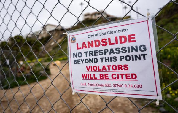
Citizens and authorities are asked to be alert to the risk of rock and mudslides in the mountains and flooding in both small and larger rivers and streams, the NWS said.
According to the weather service, considerable and perilous snowfall is likely above 6,000 feet through Monday night, with the potential for lower elevation snow down to around 4,000 feet by later Tuesday into Wednesday.