Florida’s Miami-Dade County—covering Miami, Miami Beach, and much of southeast Florida—has issued evacuation orders for over 150,000 residents.
The order took effect Thursday morning and calls on residents to find higher ground as Hurricane Irma rips its way up the Caribbean towards Florida. The order covers the county’s barrier islands and the entire southeastern coastline of Florida.
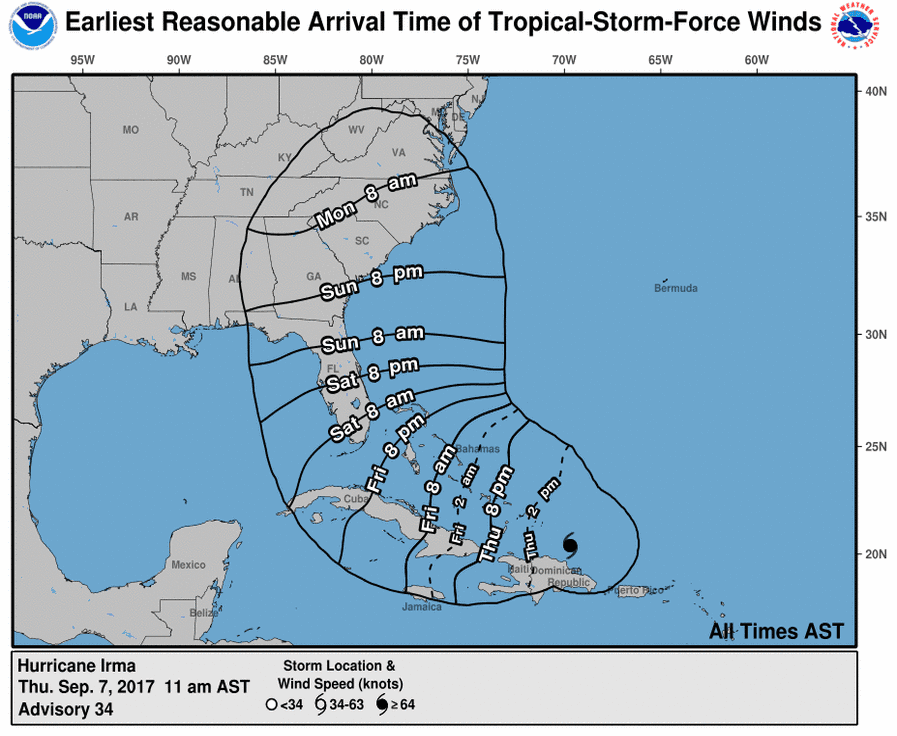
Irma is currently battering the Dominican Republic and is predicted to continue on to through the Bahamas and turn slightly north to begin its assault on Florida sometime overnight between Friday night and early Saturday morning.
Miami-Dade County Mayor Carlos Giménez dashed hopes that Irma could be spent by the time it reaches the U.S. mainland.
“Irma remains a strong Category 5 hurricane,” Giménez told reporters Wednesday night. “Significant weakening is not expected.”
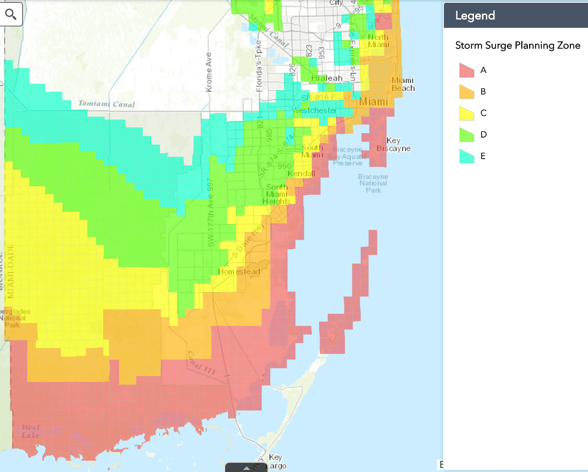
In an updatable color-coded map, the county has blocked out the immediate evacuation areas in red—Zone A—for immediate evacuation. Parts of Zone B—Miami Beach and the barrier islands between Biscayne Bay and the ocean, as well as Bal Harbour, North Bay Village, Golden Beach, Indian Creek Village, Bay Harbor Islands, Sunny Isles Beach, and Surfside—are also covered by the order.
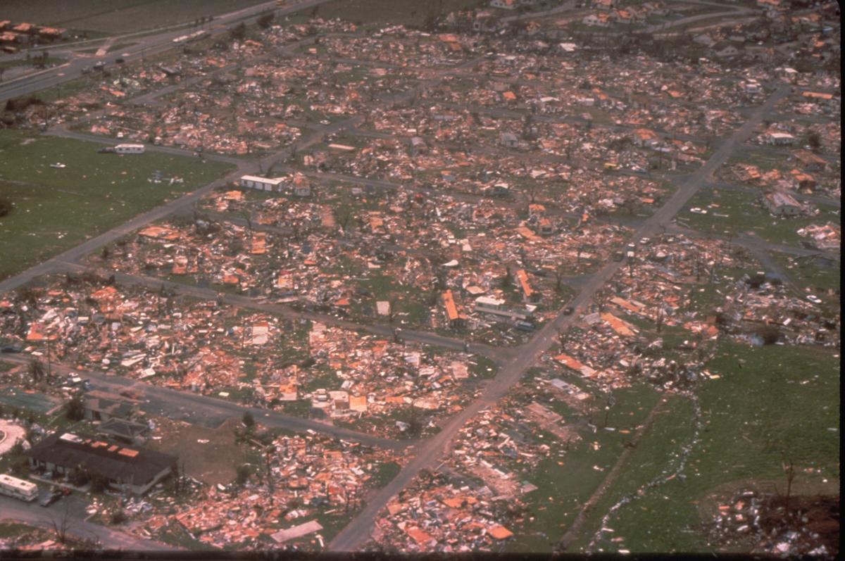
Mobile-home dwellers across the county have been put on evacuation notice as well. Hurricane Andrew wreaked havoc on mobile homes in 1992. It was the worst hurricane to ever hit the state and had sustained winds reaching 165 mph. Hurricane Irma has reached winds of up to 185 mph.
Broward County, just north of Miami-Dade, issued an evacuation order to take effect at noon on Thursday, also covering its coastline. Monroe County, which includes the Everglades and barrier islands off the southern tip of Florida, made its evacuation order mandatory on Wednesday, including Navy air station Key West.
The county is directing social media-savvy residents to get official updates from agency twitter feeds.