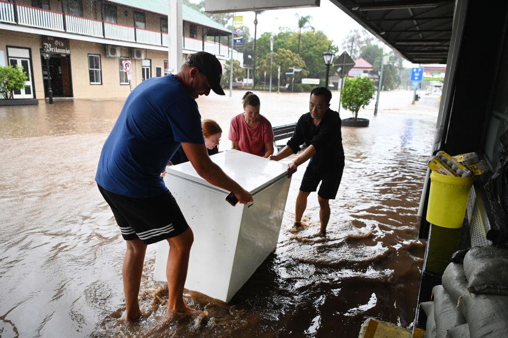
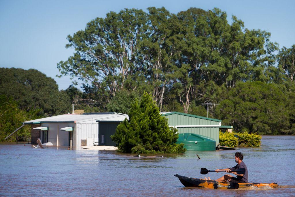
Flood-weary parts of eastern Australia are bracing for more rain-heavy storms and emergency services are pleading with people to heed warnings as wild weather extends to more states.
Days of heavy rain have polluted dozens of beaches around Melbourne’s Port Phillip Bay and rainfall totals of more than 200mm are forecast for eastern NSW and southeast Queensland from April 4 to April 6.
Queensland Premier Steven Miles said the state was only just recovering from floods so the latest onslaught of rain heightened the possibility of more damaging river rises.
He urged residents to be cautious and watch for warnings.
“I assure Queenslanders and the Queensland community that we’re ready for whatever nature throws at us,” Mr. Miles said on April 3.
The Darling Downs, Granite Belt and Maranoa in Queensland’s southwest are set to cop heavy rain and storms.
“Widespread shower activity could result in falls between 20mm to 50mm if we do see thunderstorm activity,” the Bureau of Meteorology’s Daniel Hayes told AAP.
Those rainfall totals could exceed 100mm in towns such as Charleville, Roma, Dalby, Warwick, Toowoomba and Goondiwindi extending to the Gold Coast.
Brisbane will not escape the wet weather with potential falls up to 50mm.
This could lead to flash flooding for already saturated areas after months of soaking weather.
Flood watches have been issued for the Warrego, Upper Condamine, Macintyre, Weir and Moonie River catchments.
The weather system will track further south to the NSW coast as two troughs meet on April 4.
But the wet weather will not stop there for Queensland, as a trough over the Coral Sea moves towards the northeast of the state on April 5, bringing rainfall totals between 30mm and 40mm to the Mackay region over the weekend.
The NSW State Emergency Service anticipates a flurry of requests for help as the trough soaks the state.
NSW SES assistant commissioner Sean Keans urged east coast, Blue Mountains and metropolitan Sydney communities to prepare for poor weather by cleaning gutters, trimming trees and branches and securing loose items around homes.
“We still have a few days until the weather may deteriorate, so it’s a good time to make sure you take steps to prepare your homes,” he said.
Emergency assets and crews have been pre-positioned ahead of the forecast wild weather.
“We’re pleading with the community to be prepared, stay informed and not drive through floodwaters,” Mr. Keans said.
Communities in the New England and Northern Rivers regions and the northern half of the mid-north coast should expect falls of 30mm to 50mm and up to 100mm in some areas.
The bureau is forecasting the trough will deepen on April 5 and potentially develop into an east-coast low, impacting the NSW mid-north coast before shifting to the Hunter, Sydney, Blue Mountains and Illawarra.
“That may bring damaging winds, heavy rainfall and dangerous surf to much of the coastal area,” bureau meteorologist Sarah Scully said.
A major flood warning has been issued for the Hawkesbury Nepean River with residents in low lying areas warned to prepare before April 5.
Moderate flood warnings for the Colo, Wollombi Brook and Lower Hunter Rivers are in place.
Sheep graziers in NSW and Queensland are being warned the cold temperatures, rain and winds could impact their flocks if animals are exposed to the conditions.
Melbourne was hit by the equivalent of one month’s rain on April 1, while some parts of Victoria recorded rainfall not seen for more than 150 years.