The City of Port Alberni has issued a local state of emergency as a “precautionary measure” due to the raging Mount Underwood Wildfire located south of the Port Alberni community on Vancouver Island.
The mayor also indicated that while there is “no imminent danger” to the majority of Port Alberni or its surrounding areas, residents should be prepared as the “wildfire is unpredictable.”
“BC Wildfire highlighted the challenging nature of this fire, and how unprecedented it is for our area,” Minions said. “This situation must be taken seriously even though we do expect the fire to shift away from our community again in the very near future.”

The Mount Underwood wildfire was first discovered late in the afternoon on Aug. 11 and is currently burning “out of control,” meaning the fire is spreading or is expected to spread beyond the current perimeter.
The wildfire service says that while the fire is not currently a threat to Port Alberni, Bamfield, or Youbou, the road between Port Alberni and Bamfield is closed and Bamfield has no power and its services are limited.
BC Wildfire Service Response
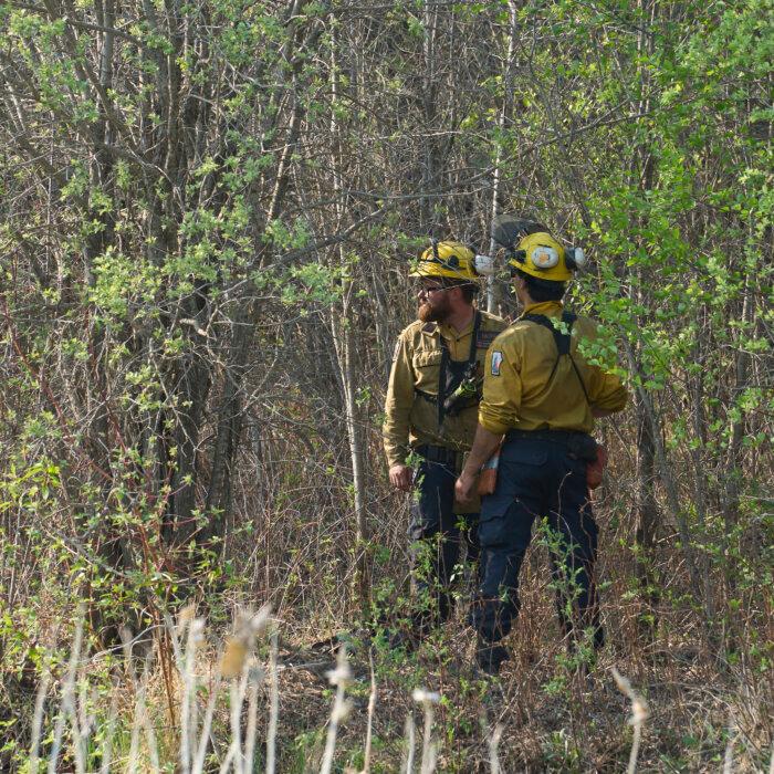
The B.C. Wildfire Service says its initial attack crew, air tankers, and helicopters responded quickly to the discovery of the fire on Aug. 11, with additional firefighters, night vision equipped helicopters, and structural protection specialists assisting later that evening.The China Creek Regional Park and Campground in the area was evacuated that evening and structure protection work is now in place for China Creek and the private campgrounds, mills, and log sorting facilities in the area of the wildfire, the wildfire service says.
According to the B.C. Wildfire Service, the fire is displaying rank 4 and rank 5 behaviour and is a “highly vigorous surface fire.” The wildfire service also noted this is “unusual” fire behaviour for Vancouver Island, which has been experiencing “severe” drought with little rain since the end of June.
“Starting Friday, we do expect conditions to cool down and some rain is expected, which will assist our response efforts, however, it will take significant rain to have a meaningful impact,” the wildfire service said.
Drones Prohibited From Flying in Wildfire Area
The B.C. Wildfire Service says someone was reportedly flying a drone in the area of the Mount Underwood fire on Aug. 12, which it says is “extremely dangerous” and a “significant safety risk” to personnel.The risk is more severe when low-flying firefighting aircraft are present in the area, as a collision with a drone could result in “deadly” consequences, the wildfire service says.
“A reminder to the public: when you fly drones near a wildfire, all aerial response must stop,” the B.C. Wildfire Service said, noting that anyone found flying a drone near a wildfire could face a fine of up to $100,000 and/or up to one year in jail.
A five nautical mile radius around any smoke or fire and 3,000 feet above ground level in the vicinity of a wildfire is automatically considered to be restricted airspace and the use of drones, or unmanned aerial vehicles, is prohibited by Transport Canada and the B.C. Wildfire Service.