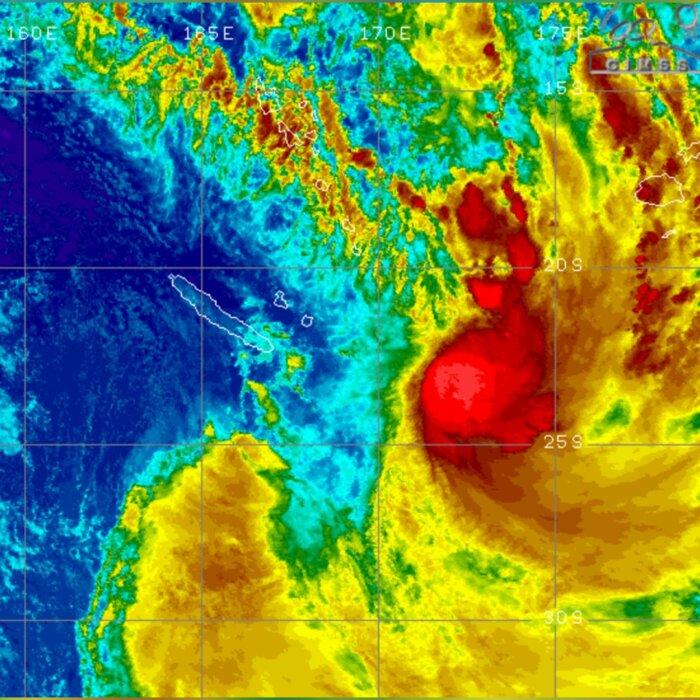
After enduring a day of storms classified by MetService as posing a risk to life, New Zealanders have awoken to more rain, continued high winds, and a new hazard—lightning strikes—as a persistent band of low pressure pummel the country.
Many parts of the South Island are under water, and a state of emergency remains in place.
Christchurch, the largest city in the South Island, experienced its wettest April day since the MetService began keeping records in 1943.
Nearly twice the usual monthly rainfall for April fell in just 24 hours—over 80 mm of rain.
Nearby, the Banks Peninsula was the worst hit, with about 300 mm of rain falling over just two days.
Flooding and landslides have forced hundreds of people to evacuate their homes across the country. Many roads and schools are closed, and authorities say it is too soon to know when residents can return safely.
In one dramatic example, what was once a road—State Highway 57—was transformed into a fast-moving river.

Power is slowly being restored to all but the worst-affected areas of the country, with line companies reporting that they have been called back to restore electricity to areas they had previously fixed.
Winds have also been destructive, particularly in Wellington, the capital, which is notoriously known as the southern hemisphere’s “windy city.”
On May 1, Wellington Airport was battered by southerly winds of 118 km/h—the strongest since 2013. Offshore, waves reached 12 metres high.
Some flights have resumed, but strong winds continue to make landings difficult, and ferry services across the Cook Strait remain cancelled.
Situated almost at the top of the North Island, New Zealand’s largest city Auckland had escaped the worst of the weather over the previous two days, but around midday on May 2, hail and thunderstorms moved across the city, with the MetService reporting 162 lightning strikes, accompanied by hail up to 20 mm wide.

In Wellington, a high-tech weather station on top of a mountain shut down after recording wind gusts of up to 168 km/h.
Forecasters say the worst may soon be over. Weather conditions are expected to improve gradually starting May 3, with sunshine possible in some areas by May, offering a vital window to assess the damage and start the clean-up.