
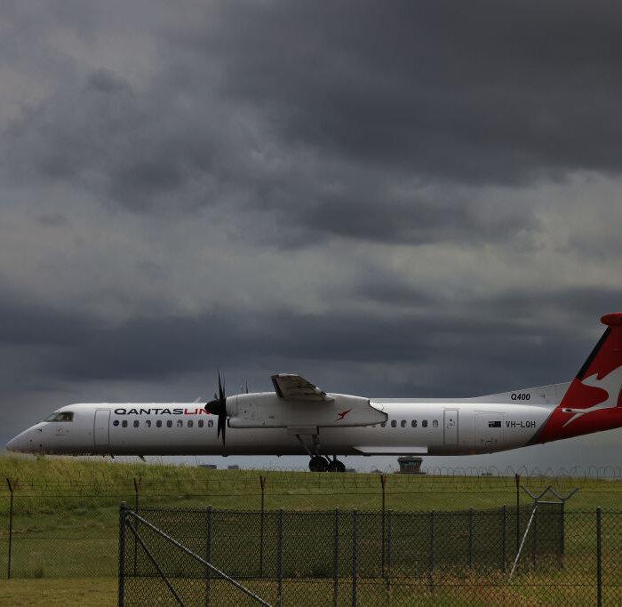
Dozens of UK flights have been cancelled as Storm Kathleen brings winds of up to 70 miles per hour—and potentially the hottest day of the year so far.
About 70 flights departing and arriving at UK airports before midday on Saturday have already been cancelled as the Met Office issued a yellow weather warning for wind.
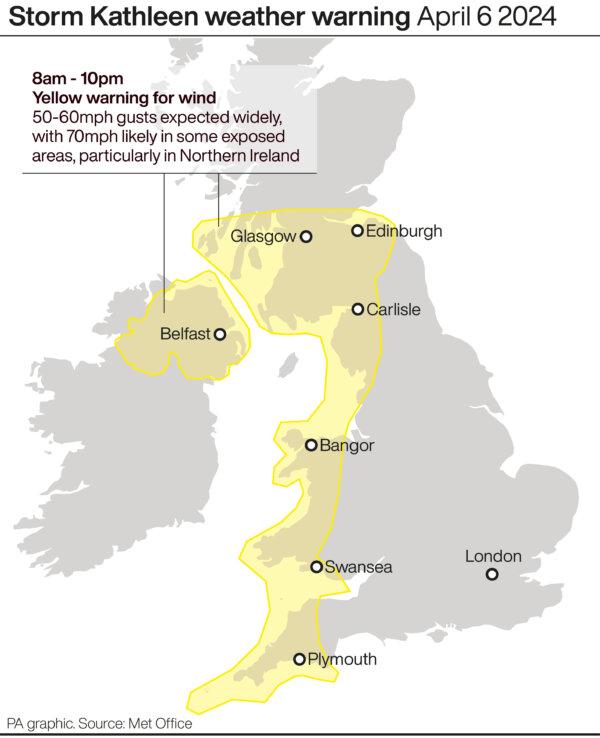
The warning covers the north-west and south-west of England and parts of Northern Ireland, Scotland, and Wales, from 8 a.m. to 10 p.m.
A further yellow warning for wind has been issued for north-west Scotland on Sunday between 9 a.m. and 3 p.m., with gusts of up to 70mph expected again, according to the Met Office.
And temperatures could reach up to 22C in East Anglia on Saturday as warm air comes in from the continent.
Met Office meteorologist Ellie Glaisyer told the PA news agency: “The storm is the reason we are seeing the warmer temperatures, because the location of the storm—situated out towards the west of the UK—is bringing a southerly wind across the UK.

“This is bringing those warmer temperatures from the continent, meaning we are likely to see temperatures reaching 22C.”
The highest temperature of the year so far was 19.9C, recorded at the end of January at Achfary in north-west Scotland.
Storm Kathleen is also expected to bring 50-60mph winds quite widely on Saturday, while some Irish Sea coastal regions will see gusts up to 70mph and large waves.
Winds of 56mph have hit the Isles of Scilly off the Cornish coast on Saturday morning, the forecaster said.
Ms. Glaisyer added: “Almost anywhere is going to see above-average temperatures. Western parts of the UK are likely to see temperatures of 15 or 16C.
“However, the further west you are, where those strongest winds are in that yellow warning area, despite the temperatures being above average it will feel a little colder.”
On Friday, the Met Office updated its weather warning to forecast stronger gusts during Storm Kathleen than previously predicted.
It warned of injuries and danger to life from “large waves and beach material being thrown on to sea fronts, coastal roads, and properties,” a possibility that “road, rail, air, and ferry services may be affected” and the potential for power cuts and phone service outages.
Storm Kathleen will ease on Sunday evening, but another weather system towards the South West will replace it, Ms. Glaisyer added.
She said: “Outbreaks of rain through Monday will mainly affect western parts of the UK. As we go through the day into Tuesday we’re likely to see the strongest wind across the south-west of the UK.
“It’s coming relatively quickly after Storm Kathleen.
“It’s not out of the question that a warning could be issued but I wouldn’t like to say yet.”
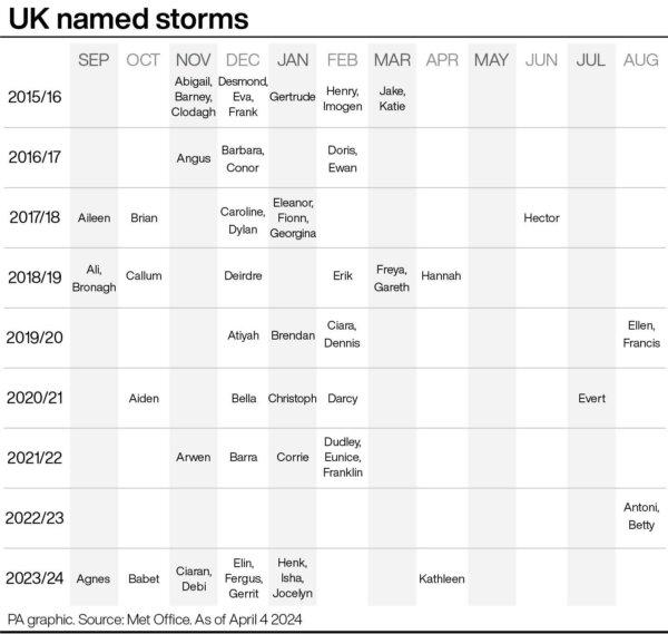
Storm Kathleen, named by the Irish meteorological service Met Eireann, is the 11th named storm in eight months.
It is only the second time in a UK storm season that the letter K has been reached in the alphabet.
The Met Office’s shipping forecast had 29 gale warnings in place on Saturday morning for sea areas including Viking, Plymouth, Biscay, Sole, and Lundy.
The Environment Agency issued 14 flood warnings—where flooding is “expected”—and 113 flood alerts in England on Saturday, with National Resources Wales issuing six flood alerts.
The Environment Agency also issued 45 red cautions for strong streams on the River Thames, advising users of all boats not to navigate.
RAC Breakdown spokesman Rod Dennis said: “This intense period of stormy weather is going to prove extremely challenging for anyone driving on the western side of the UK.
“We strongly urge drivers to avoid exposed coasts and higher routes where the impact of the very strong winds is most likely to be felt.”


