Weather warnings are in place throughout Canada this week as a polar vortex brings frigid temperatures to the West and blustering winds and blowing snow to the Atlantic provinces.
Ontario and Quebec
After a blast of heavy snow and rain earlier this week, The Weather Network is forecasting up to 30 centimetres of snow for some areas and blizzard-like conditions for both provinces.“Forecasters are closely watching [a] massive and powerful Colorado low, as it tracks from the Great Lakes to northern Quebec,” The Weather Network said. “This weekend storm will potentially fulfill the criteria for a weather bomb.”
The low pressure system will strengthen as it heads northeast into the Great Lakes region bringing widespread strong winds and heavy snow late Jan. 12 and into Jan. 13.
The Weather Network is predicting “significant” snowfalls in some areas with the risk of “extensive blowing and drifting snow, and localized wind damage and power outages.”
The storm will hit southwestern Ontario late in the afternoon Jan. 12 and will quickly intensify by the evening with heavy snow and wind gusts between 60–80 km/h.

The system will hit the rest of the province by midnight with snowfall rates as high as three to five centimetres per hour.
“The heaviest snow will fall late evening and through the overnight hours,” lingering through the morning of Jan. 13 for eastern Ontario, including Ottawa, the Weather Network said, adding that the “line between significant snow and rain/snow mix will once again be razor thin for the GTA and Golden Horseshoe.”
In Quebec, the western and southern parts of the province can expect the snow to begin overnight on Jan. 12 with the storm reaching Eastern Quebec during the day on Jan. 13, Environment Canada says.
Extreme Cold
Environment Canada has issued an extreme cold warning for parts of British Columbia, Alberta, Saskatchewan, Manitoba, the Northwest Territories, and the Yukon as an arctic air mass settles over much of Western and Northwestern Canada.The Yukon will be hardest hit as temperatures dip to -40 Celcius. Combined with intermittent northeast winds up to 15 km/h, wind chill values will sink as low as -55 C. The story is similar in the Northwest Territories with -50 C wind chills expected to return to many regions overnight on Jan. 11.
Northern B.C. will see temperatures between -30 C and -40 C with northerly winds up to 20 km/h generating wind chill values of down to -45 C. Strong outflow winds will generate wind chill values as low as -30 C across the province’s north and central coast while Haida Gwaii and North Vancouver Island can expect wind chills near -20 C.
Much of Alberta can expect chilling winds as low as -40 C on Jan. 11 but, as air temperatures continue to fall through the end of the week, residents can expect a blisteringly cold weekend as the thermometer drops to -40 C and wind chills approach -50 C.
An arctic air mass is forecasted to move through Saskatchewan on Jan. 11 and persist through the weekend.
“Although temperatures are expected to slightly moderate during the day, they will once again drop to near or below -30 C in parts of the region” overnight Jan. 11 and the following nights, Environment Canada says. “When combined with winds of 15 to 25 km/h, this will result in wind chill values ranging from -40°C to -50°C at times over the coming days.”
Northwestern Manitoba is also being impacted by the vortex with wind chills as low as -50 C expected this morning.
Environment Canada says it expects the frigid weather to persist throughout the North, B.C., and the prairies until the weekend as warning residents to exercise extreme caution.
“Extreme cold puts everyone at risk,” Environment Canada said. “Extreme cold warnings are issued when very cold temperatures or wind chill creates an elevated risk to health such as frostbite and hypothermia. Risks are greater for young children, older adults, people with chronic illnesses, people working or exercising outdoors, and those without proper shelter.”
Newfoundland
Newfoundland’s southwest coast remains under a weather warning with 70 km/h easterly wind gusts with 10 to 20 centimetres of snow expected in most areas with up to 30 centimetres falling over higher terrain.Environment Canada expects the storm to continue throughout the day on Jan. 11 with whiteouts and blowing snow, but conditions are expected to improve by evening as winds diminish and precipitation tapers off.
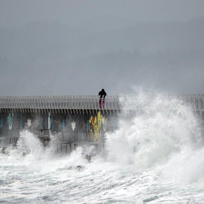
The Atlantic provinces were hammered by Mother Nature earlier this week with wind gusts exceeding 100 km/h in some areas. The Confederation Bridge between New Brunswick and P.E.I was closed to all traffic on Jan. 10, due to howling 125 km/h winds, The Weather Network said.
The extreme winds caused power outages for thousands in the eastern Maritimes and southwestern Newfoundland, particularly for those in close proximity to the coast.