Queenslanders are bracing for a potential category 3 cyclone forecast to cross the coast just weeks after wild weather lashed the region.
The Bureau of Meteorology says a tropical low in the Coral Sea is expected to develop into a cyclone, which will be named Kirrily, late on Monday.
“While our consensus track does cross it to the south of Townsville, there’s still a range of scenarios where we could see a cross between Cairns and Mackay,” Mr. Narramore said.
There’s also uncertainty about where the cyclone could track after it makes landfall.
It could move back out to sea or move south, possibly bringing heavy rain and damaging winds to parts of southeast Queensland, he said.
Emergency Management Minister Murray Watt says the impact could be significant.
“We would obviously be concerned if there was to be any further impact on those areas that were already hit by tropical Cyclone Jasper and are very much still in recovery mode,” he told ABC radio on Monday.
“But really, if we’re talking about a category three system, that could have pretty serious effects wherever it crosses landfall.”
The continued weather events could also have knock-on effects on inflation, Senator Watt warned.
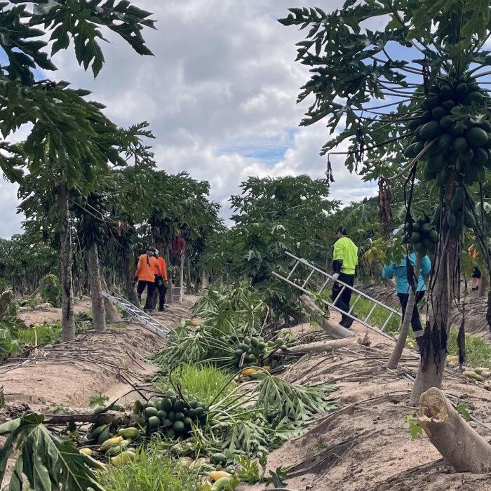
“There are some crops like all pawpaws, tropical fruits, which were directly impacted,” he said.
“But the additional impact is on supply chains.”
The Palmerston Highway, which is a key supply route, has been badly damaged but Senator Watt said there were no direct signs the weather has had an impact on produce costs and inflation at this stage.
He has held discussions with Premier Steven Miles to ensure all emergency management agencies are ready and to get supply chain routes back up and running.
Mr. Miles said his concerns rest with already-fatigued emergency service personnel and how further rainfall could impact already sodden regions.
Authorities are preparing for a third natural disaster in just over a month.
“Our greatest concern is just stretching out emergency services, the fatigue amongst them has been pretty high,” he told ABC Radio.
“We’ve been trying to rotate and rest them through, but this third disaster if it’s as bad as the bureau says it could be really will test them.”
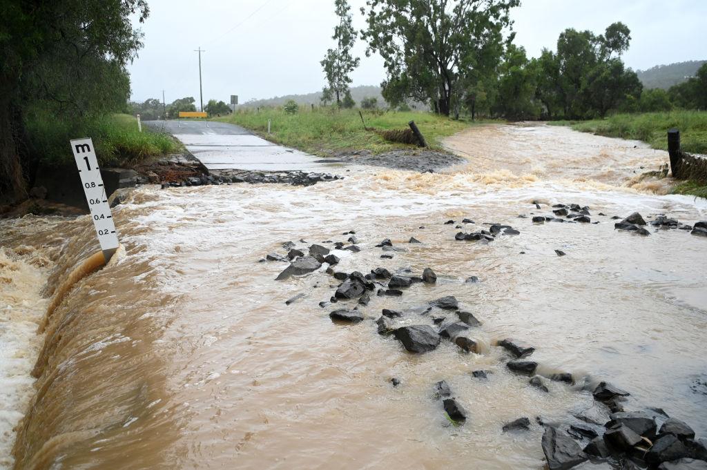
It comes as a tropical low that has caused widespread flooding, road closures and evacuations of some communities in the Northern Territory moves into Western Australia’s Kimberley.
Mr. Narramore said the system had been “persistent” and was tracking so slowly it was “hardly moving” across the NT.
The community of Kalkarindji was warned it could be isolated as the Victoria River rose to near-record flood levels on Sunday.
Some catchments along the river received up to 370mm of rain in three days.
While the system was not expected to bring as much rain to the Kimberley as it has across the NT, a severe weather warning has been issued for the region.
Heavy rainfall and flash flooding are possible and a flood watch is in place for East Kimberley, Fitzroy River, Sandy Desert De Grey River and Sturt Creek District.