Flooding, falling rock and debris, and avalanche hazards have led to the closure of all major highways between British Columbia’s Lower Mainland and the Interior, the province says.
The Fraser Valley Regional District (FVRD), the third most populated district in B.C., has declared a local state of emergency and issued evacuation orders for eight properties in the Chilliwack River Valley due to the flooding.
“This situation is evolving and very dynamic. Please pay attention to any emergency messaging and traffic controls.”
DriveBC is warning drivers that other provincial roadways could be closed with “little or no notice.”
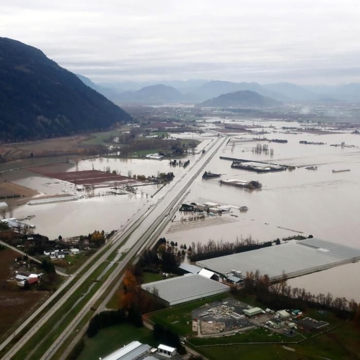

The B.C. River Forecast Centre has also upgraded the “flood watch” to a “flood warning” for the Fraser Valley East on Dec. 10, as river levels had exceeded banks or were expected to exceed them imminently and result in flooding, the district says.
The impacted areas included the Lower Fraser tributaries, such as the Chilliwack River, Skagit River, Coquihalla River, and other areas of the Fraser Valley around Abbotsford, Chilliwack, Hope, and east through Manning Park. The Sumas River is also impacted, including the potential for spillover from the Nooksack River.
“Heavy rainfall across the region yesterday has now eased. Environment and Climate Change Canada have ended rainfall warnings,” the update says.
Environment Canada had issued an “orange” level rainfall warning for the area due to 90 to 120 millimetres of rainfall from the evening of Dec. 9 to the evening of Dec. 10. The River Forecast Centre says the area observed up to 145 millilitres of rain with additional snowmelt in mid-elevations and significant snow accumulation at higher elevations.
“Heavy rain and high streamflow bring increased risk for unstable banks, river erosion, submerged roads, swift water hazards, flooding and landslides,” the River Forecast Centre said. “Stay clear of the banks of swift running rivers and never drive across flooded roads, bridges or river crossings.”
B.C. Emergency Management Minister Kelly Greene spoke at a press conference on Dec. 10, urging Lower Mainland residents to remain up-to-date on the situation and prepare for “potential impacts.” She suggested preparing a “grab-and-go bag” for every household member and creating an emergency plan.
“At this time, our roadways and travel can be particularly dangerous due to pooling water,” Greene said. “The Ministry of Transportation and Transit will have maintenance contractors monitoring conditions, clearing culverts, and prepositioning crews and equipment to respond quickly to potential flooding.”
2021 Atmospheric River
Communities in the Fraser Valley region were previously impacted by atmospheric rivers and significant flooding in 2021.Greene said at the Dec. 10 press conference that the province had put in place “a number of improvements” to help it respond to the situation this time around. She said there is stronger communication and coordination between communities, including Washington state, and there are new monitoring stations on both sides of the border.
She also said there are new cameras installed on the Canadian side of the border to help the province get the most up-to-date information possible, in addition to flood mitigation equipment positioned in the Fraser Valley.
“There are personnel on standby today who can be deployed to help communities on the ground, including with sandbagging if needed,” Greene said, adding that the province has also expanded the use of its emergency alert system.