A tropical storm warning was issued for parts of North Carolina and a tropical storm watch for the southern end of Virginia by federal forecasters on Tuesday as Hurricane Erin continues to move north.
The center of the monster storm will remain far offshore, forecasters said, but its outer edges are likely to bring damaging tropical-force winds, large swells, and life-threatening rip currents.
A tropical storm warning was issued Tuesday for Beaufort Inlet to the town of Duck, North Carolina, and a tropical storm watch was issued for north of Duck to Cape Charles Light, Virginia. A storm surge warning was in effect for Cape Lookout to Duck, according to the NHC.
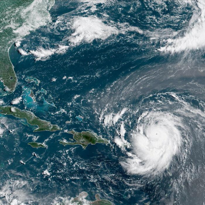
Erin is currently located roughly to the west of the Bahamas but is expected to go north before moving to the northeast, where, according to forecast models, it will pass between the U.S. East Coast and the island of Bermuda.
“Erin is expected to turn northward around the western periphery of a subtropical anticyclone centered southeast of Bermuda. Later in the period, the system should turn to the northeast with some increase in forward speed as it moves into the mid-latitude westerlies,” the Miami-based NHC said.

Aside from North Carolina and Virginia, warnings about rip currents have been posted from Florida to the New England coast, but the biggest threat is along the barrier islands of North Carolina’s Outer Banks, where evacuations have been ordered.
The biggest swells along the East Coast are expected to develop on Wednesday and last into Thursday.
By Tuesday, Erin had lost some strength from previous days and dropped to a Category 2 hurricane with maximum sustained winds of 105 mph, coming three days after it was declared a Category 5 storm on Saturday with 160 mph winds.
“A tropical wave located over the central tropical Atlantic continues to produce a broad area of disorganized showers and thunderstorms. Environmental conditions appear conducive for the gradual development of this system, and a tropical depression could form toward the end of the week or this weekend,” the agency said.
In the eastern Atlantic Ocean’s tropics, another tropical wave could form into a depression, according to the NHC. It said that the system has a 30 percent chance of formation over the coming 48 hours and seven days, respectively.