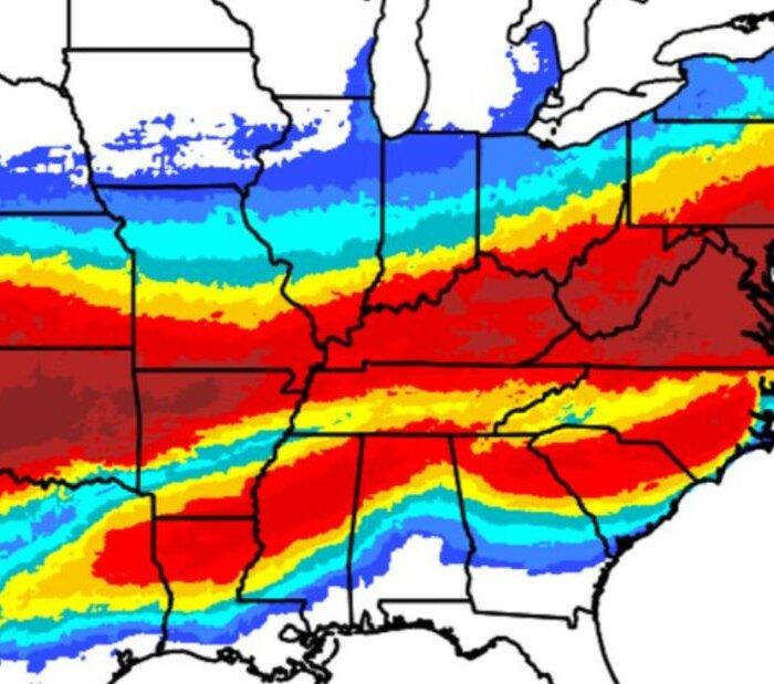
The National Weather Service (NWS) said that a winter storm could bring significant amounts of ice accumulation from New Mexico to the Carolinas, potentially causing widespread tree damage and power outages, starting Friday and lasting until the weekend.
The agency said that the forecast track of the storm is still uncertain, while its intensity is still unclear. Residents in the path of the weather system were advised to start preparing for the worst and pay attention to updates.
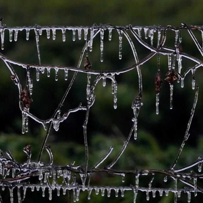
Local maximum snowfall amounts could total above 12 inches in some places, while “broad swaths” of freezing rain and sleet are expected in the southern Plains, Lower Mississippi Valley, mid-South, and Carolinas. In those areas, tree damage and power outages are likely.
Along with the winter storm, areas of the United States will experience extreme cold as “sub-zero” temperatures will spread from the Plains to the Northeast by Sunday, and the temperatures will reach the Gulf Coast states by the early part of next week, it said.
“Snow amounts could reach a foot or more in the I-95 major cities from D.C. to Boston,” said weather service forecasters on the East Coast, who are increasingly confident the storm will strike the big cities. Meanwhile, snow and ice will likely produce significant flight delays and cancellations at major airport hubs.
In Washington, “the combination of heavy snow and ice alongside prolonged very cold temperatures presents a unique and significant risk to life and property across virtually the entire region,” forecasters in the weather service’s Washington and Baltimore office warned.
The agency on Thursday warned of snow squalls that will occur on Thursday downwind from the Great Lakes area, while “a second round of snow squalls” is “possible on Friday” in the region.
“The first round of snow squalls is likely to develop across Upstate New York this morning before moving through New England, with multiple rounds of snow squalls possible in some areas,” it said.
“The second round is expected Friday afternoon and should move steadily west to east across the region.
“Snow squalls create an extremely dangerous combination of heavy snow rates and strong, gusty winds, leading to snow-covered roads and near-zero visibility. If you encounter a snow squall while driving and cannot safely exit the roadway, reduce speed, turn on your lights and hazards and avoid slamming on the brakes.”