Two tropical disturbances in the Atlantic Ocean may form into a tropical depression over the next 48 hours, the National Hurricane Center (NHC) stated on the afternoon of Aug. 20.
The agency stated that it is watching two tropical disturbances to the east of Erin that are showing signs of organization and could develop into named storms. With thousands of miles of warm ocean water, hurricanes known as Cape Verde storms are among the most dangerous that threaten North America.
“By the end of the week, environmental conditions are expected to become unfavorable for further development,” the NHC stated, noting that it could become a “short-lived tropical depression.”
The other tropical disturbance, located near the Leeward Islands that separate the Caribbean and the Atlantic Ocean, could develop and form into a tropical depression “by this weekend while it moves near or to the north of the northern Leeward Islands.”
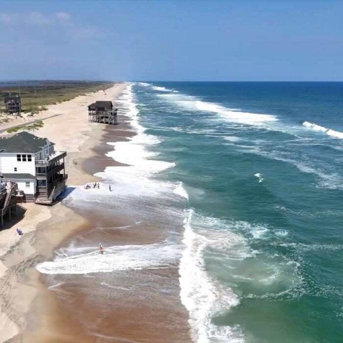

While Erin is unlikely to make landfall along the East Coast before turning farther out to sea, authorities expect its large swells will cut off roads to villages and vacation homes on North Carolina’s Outer Banks and whip up life-threatening rip currents from Florida to New England.
New York City closed its beaches to swimming on Aug. 20 and Aug. 21. Some beaches in New Jersey, Maryland, and Delaware will also be temporarily off-limits.
Off Massachusetts, Nantucket Island could see waves of more than 10 feet later this week. But the biggest threat remained along the Outer Banks of North Carolina.
Erin remained a strong Category 2 hurricane on Aug. 20 with maximum sustained winds at about 110 miles per hour, according to the agency. It was about 365 miles south-southeast of North Carolina’s Cape Hatteras.
The NHC warned that roads in the low-lying barrier islands may become impassable, with waves as high as 20 feet crashing ashore. The heavy surf is likely to result in significant beach erosion, it said in an Aug. 20 update.
North Carolina Gov. Josh Stein declared a state of emergency on Aug. 19, freeing up state money and manpower to help during the storm and its aftermath.
Earlier in the week, the coastal counties of Dare and Hyde ordered residents and tourists to evacuate the vulnerable Ocracoke and Hatteras islands, whose populations swell during the summer months.
Erin, the fifth named storm of the 2025 Atlantic season and the first to attain hurricane status, had strengthened to a Category 5 storm. The last Atlantic storm to reach that intensity was Hurricane Milton in October 2024.