Hurricane Idalia is continuing to intensify, barreling toward Florida’s Big Bend as forecasters and state officials warn its projected 120 mile-per-hour winds could push a 15-foot wall of water ashore when it makes landfall sometime after 8 a.m. on Wednesday.
“It is definitely going to hit the Big Bend—everywhere in the Big Bend,” Florida Gov. Ron DeSantis said, issuing his fourth update of the day during a 6 p.m. press conference at the Florida Emergency Operations Center (EOC) in Tallahassee an hour after the National Hurricane Center’s (NHC) posted its 5 p.m. bulletin.
As of 5 p.m. Tuesday, NHC reported that Idalia has strengthened into a Category 2 hurricane with sustained winds topping 100 miles per hour, moving directly north at 16 mph about 190 miles southwest of Tampa and 300 miles south of Tallahassee.
Idalia appears to be on track to make landfall sometime after daybreak anywhere along the 130-mile span from Florida’s Nature Coast, north of Tampa Bay to the Aucilla River south of Tallahassee in the sparsely populated Big Bend area where Florida’s Panhandle curves into the peninsula.
There’s been a steady “western shift” in NHC’s projected storm path since Monday, Mr. DeSantis said, with the projected landfall edging into the Big Bend area and closer to the Panhandle with a post-landfall path projected to power north into Georgia and the Carolinas, giving Florida’s northern Atlantic coast a glancing blow.
“So the impact is going to be further north and it is going to bring more direct impacts into counties like Leon, Jefferson, and Collin counties,” he said. “It seems like most of these models are in agreement about the general area so it’s definitely going to make the Big Bend” by Wednesday morning.
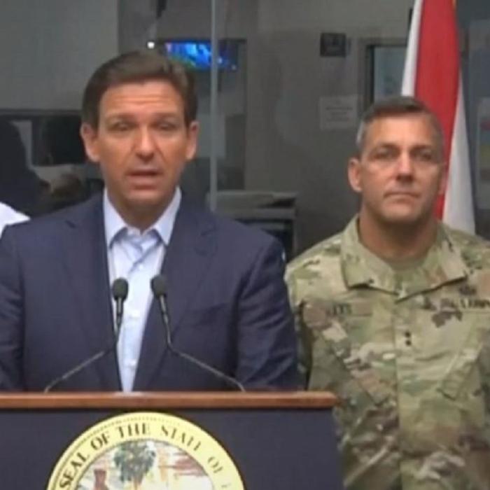
“These things change,” the governor cautioned about forecasts, noting the most imminent danger Idalia presents is not its winds and rains but its projected storm surge, which forecasters have been steadily increasing since Monday.
“The Big Bend is going to get a major storm surge,” he warned before adding that anyone in low-lying areas along the Gulf Coast is “going to see major, major impacts whether the eye wall is hitting you or not. So, please prepare for that. There’s going to be a significant impact to that region of Florida.”
Mr. DeSantis, who suspended his Republican presidential campaign to lead the state’s emergency storm response, said that Floridians from Key West to Fort Myers—who are still recovering from Category 5 11 months ago—were already seeing effects from the storm by mid-afternoon.
“We’re seeing storm surge” across Southwest Florida, he said. “I mean, the eye of the storm is probably 100 miles or more off the coast and yet those outer bands are already showing significant impact. So, you’re going to see impacts all up and down the west coast of Florida as the night goes on and as we get into the wee hours of tomorrow morning.”
First Hurricane for Big Bend Since 1896
Idalia, barely a smudge on the radar days ago, has mushroomed into a 150-mile wide hurricane within the span of four days.The first named storm to make landfall in the United States this June-November Atlantic hurricane season, Idalia hammered western Cuba’s tobacco-producing province of Pinar del Rio with 4 inches of heavy rains before steaming across the Florida Strait and into the Gulf of Mexico early Tuesday.
Florida’s sparsely populated Big Bend area has somehow avoided over the last century the direct landfall hits the Panhandle to the west has endured, such as 2018’s Category 5 Michael, and the central Florida has seen, such as 2022’s Ian and 2017’s Irma.
The National Weather Service in Tallahassee called Idalia “an unprecedented event,” since no major hurricanes on record have hit the region since the 1896 Cedar Key storm that left 70 dead.
“You really got to go back to the late 1800s to find a storm of this magnitude that will [make landfall] where this one looks like it’s going to tomorrow,” Mr. DeSantis said. “So, you don’t really have historical analog in anybody’s memory. It’s likely to cause a lot of damage and that’s just the reality. So, everybody hang in there.”
Storm Surge
Storm surge is the water that is pushed ashore by storms that go beyond the standard twice-daily tide changes. A high tide can significantly magnify storm surge.Since Monday, the NHC has steadily increased projected storm surges in the storm’s path and surrounding areas from 8-to-10 feet on Monday to 12 feet by Tuesday morning to now, as high as 15 feet in a 130 swath of the Nature Coast and Big Bend—from Yankeetown north to the Aucilla River south of Tallahassee on the western arc of Florida’s Big Bend coast.
“The deepest water will occur along the immediate coast in areas of onshore winds, where the surge will be accompanied by large and dangerous waves,” the NHC said in its midday Tuesday update. “Surge-related flooding depends on the relative timing of the surge and the tidal cycle, and can vary greatly over short distances.”
Florida’s entire Gulf Coast from south of Tampa Bay to the Panhandle is projected to see at least a 7 feet of storm surge from Idalia. Tampa Bay, about 150 miles south of the Big Bend, expects to see a 4-to-7 foot storm surge.
Evacuations
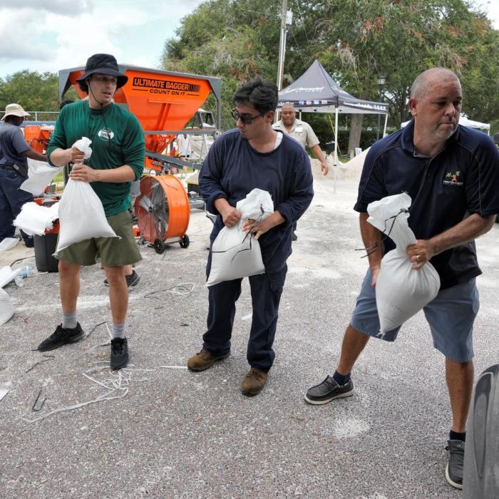
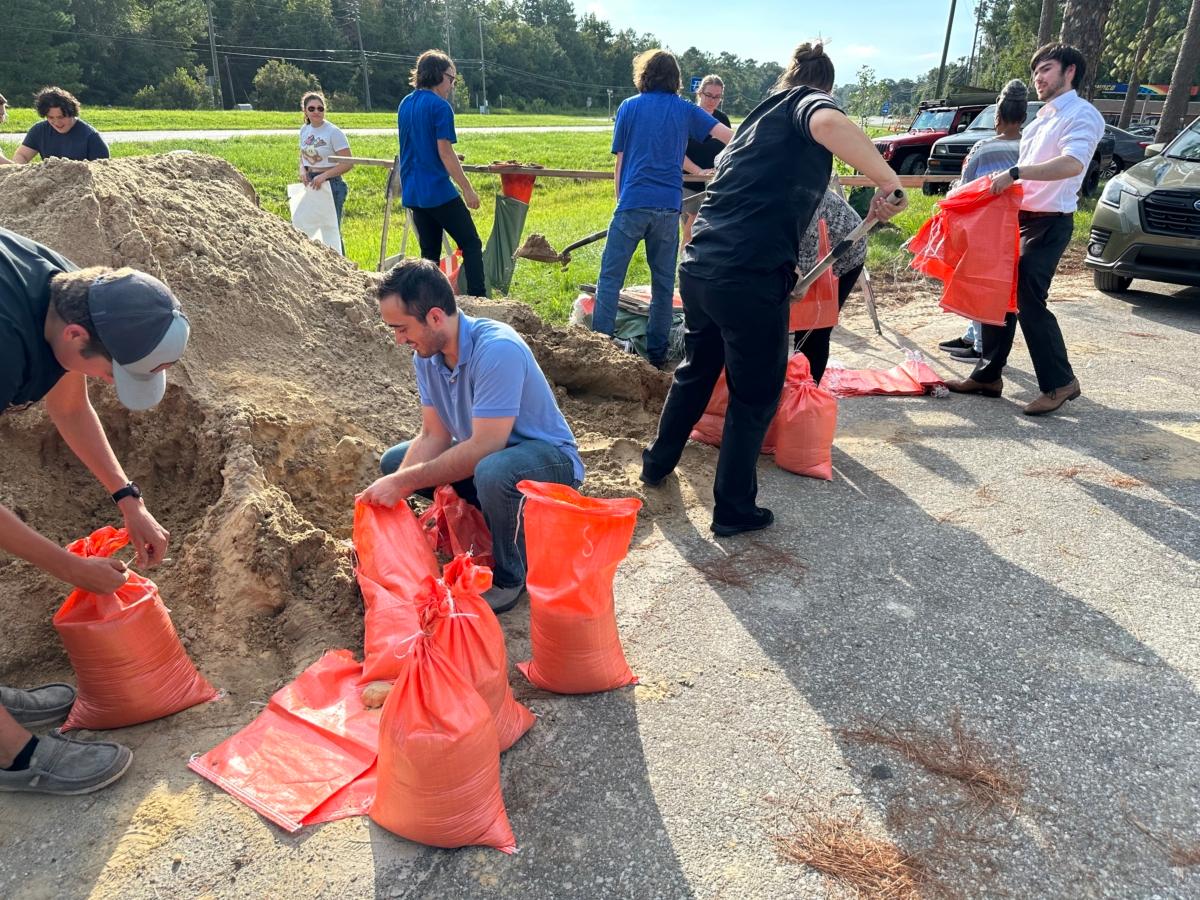
People in tropical flood zones in low-lying coastal and inland waterway areas in 28 counties are under orders to evacuate. There were 21 counties under such orders Monday night.“You run from the water and you hide from the wind,” Mr. DeSantis said, encouraging those living in low-lying areas outside the storm’s projected path to also seek higher ground.
The governor said that anyone living in a tropical storm flood zone on Florida’s west coast means “you are in an evacuation zone and you’ve been directed to evacuate, particularly if you’re in a low lying area or coastal area.”
For anyone in the Big Bend region, Mr. DeSantis told hold outs to leave while they can.
“Now’s the time to do that. You still have a little bit more time. If you wait much longer, by the time we get in further into tonight, the weather is going to start getting nastier and nastier. And we’re looking at an impact of the eye wall arriving sometime tomorrow morning. So, you really got to go now.
Shelters and Lodging
More than three dozen shelters are open along Florida’s Gulf Coast with more readying to shield residents opening through the day and night across the northern tier of the state.“You do not have to leave the state” to escape the storm, Mr. DeSantis has repeated across numerous updates since Sunday evening. “You don’t have to drive hundreds of miles to get to higher ground and a safe structure. You can ride the storm out there, then go back to your home once the storm passes.”
“Visit Florida,” the state’s tourism marketing agency, has activated its Emergency Accommodations Module with Expedia to provide “real-time availability of hotel rooms throughout the state” for Floridians fleeing evacuation zones.
In addition, the Florida Restaurant and Lodging Association has announced that in-state hoteliers have waived their no-pet policies.
States of Emergency
Mr. DeSantis declared states of emergency in 49 of Florida’s 67 counties on Sunday, Aug. 27. Inland Brevard, Orange, and Osceola counties were added to the list Tuesday morning. President Joe Biden designated Florida to be in a federal state of emergency on Monday.National Guard and Coast Guard
Florida’s “full” 5,500 National Guard force has been activated and prepositioned near expected landfalls in four task forces. They bring 2,400 high-mobility, high-water vehicles, 14 aircraft, and 23 small watercraft to the effort. National Guard forces from Tennessee and South Carolina are also in Florida.The Coast Guard’s 7th District has established a command post for the storm at Coast Guard Air Station Miami in Opa Locka. Five of the seven 7th District Coast Guard stations are in Florida, but only one—St. Petersburg-Clearwater—is on the state’s Gulf Coast.
Power Restoration
More than 25,000 out-of-state linemen from as far away as Nebraska are already in the state. At least 15,000 more are on-call, with the governor estimating that at least 30,000 will be on the ground early Wednesday to surge to wherever need is the greatest.The state also has 750 Starlink internet devices ready for deployment. They are stationed in staging areas as far south as Tropicana Field in St. Petersburg, as far north as the Florida-Georgia state line, and as far west as Chipley in the Panhandle.
Florida Power & Light, (FPL), the state’s largest electricity company, said on Tuesday it had mobilized a “restoration workforce” of approximately 12,000 “strategically pre-positioned” in 18 sites “to quickly start work as soon as the storm clears and it is safe to do so.”
“As Hurricane Idalia intensifies and quickly approaches Florida, we urge customers to prioritize their safety. Resist the temptation to trim trees or clear debris in these final hours before landfall. In the aftermath of the storm, do not approach downed power lines or try to walk through flooded areas,“ FPL President and CEO Armando Pimentel said. ”We prepare all year for hurricane season, and we are ready to bring the lights back on for customers safely and as quickly as possible and get through these challenging days ahead together.”
The 12,000 linemen, many from out-of-state power companies, are at sites in Chipley on the Panhandle, Jacksonville, and Sarasota County.
Duke Energy is staging emergency workers at Wildwood where they met with Mr. DeSantis on Tuesday.
There is only one certainty for those in the path of the storm. “Be prepared to lose power. And just know that there’s a lot of folks that are going to be there to help you get back on your feet,” he said.
First Responders
More than 600 urban search-and-rescue team members are assembled and 33 ambulance strike-teams with more than 200 ambulances.Schools
Classes in 42 school districts, 16 colleges and seven universities have been canceled at least through Wednesday,Transportation and Gas
Toll-collecting booths on state turnpikes in central and west Florida are closed allowing free egress. The state has 1,100 generators ready to be deployed to restore power to traffic signals.The state’s Department of Transportation (DOT) has bunkered more than 1.1 million gallons of gas available to stations in the most heavily affected areas. More that 670 DOT workers, including 100 bridge inspectors, 140 dump trucks, 200 pieces of heavy equipment, and nearly 60 pump trucks, are staged and ready to go wherever first-responders need them to pave the way.
If winds reach 40 mph, DOT officials warn, the state highway patrol and local authorities must close coastal bridges.
Mr. DeSantis said that Uber announced on Tuesday it will offer “free round-trip rides to and from evacuation shelters with a value of up to $35.”