An extreme heat wave is grilling the southern United States, bringing scorching temperatures and putting over 100 million Americans under various grades of heat alerts, with forecasters warning that the worst is yet to come.
Over the past week or so, forecasters have been warning of a long and intense heat wave coming for the U.S. Southwest that could well rank among the most severe in recent history.
So far, NWS has issued excessive heat advisories, watches, and warnings for areas in which around 100 million Americans live.
The focal point of the blistering heat in the United States is expected to fall mostly in Arizona, California, and New Mexico, as well as parts of Texas, with peak intensity expected on Saturday, according to NWS regional offices.
‘Extreme Heat’ in Arizona
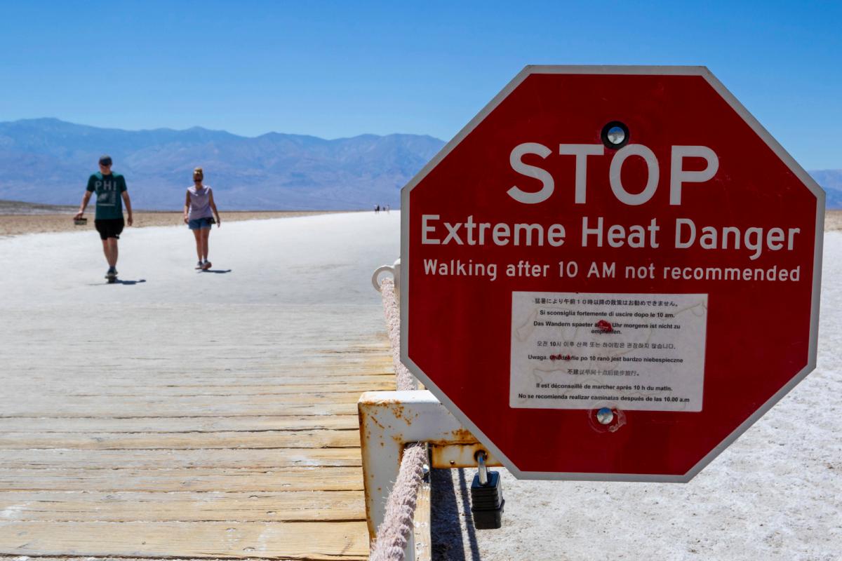
In Phoenix, there have been nearly 14 consecutive 110-plus-degree days, with forecasts predicting that the city will break its record of 18 straight days over 110, which was set all the way back in 1974.Forecasters at NWS Phoenix said in an advisory that the long-duration heatwave is expected to persist through early next week, with the heat risk level rising to “major” and “extreme” levels on Friday and into the weekend.
Even though models updated on July 14 are predicting temperatures in Arizona to slowly decrease early next week, NWS Phoenix forecasters say that residents won’t likely feel much relief because of increasing moisture and “so in reality how hot it actually feels like may not be any different than over the weekend.”

Near record heat continued across Arizona on Friday, with an excessive heat warning in effect across the lower deserts.
Parts of California ‘Dangerously Hot’
In California, inland temperature forecasts predict readings of 110 degrees or more in some locations on Saturday, with some areas showing a 90-plus percent chance of breaking daily records.Over 50 percent of California’s population is currently under a heat advisory or excessive heat warning.
“Highs will peak between 100 to 110 degrees, and possibly higher,” the agency said, adding that the most intense heat is expected over the LA County interior.
Heat warnings and advisories blanket all non-coastal areas in California.
There is a possibility of a “little cooling” in coastal areas on Saturday and so NWS Los Angeles is keeping a heat advisory there rather than a full warning.
“Though cooler, the temperatures will still be dangerously hot,” the forecast said.
“There is a high to very high risk for much of the population due to long-duration heat with little to no overnight relief,” the agency said.
“Prepare for dangerous heat, limit outdoor activities,” it added.
‘Numerous Daily Record Highs’ in New Mexico
New Mexico is bracing for scorching temperatures across much of the state, while another round of strong to severe storms is expected across northeast New Mexico, NWS forecasters said.A backdoor cold front will move across the eastern part of the state later on Friday, however, which is likely to bring with it cooler temperatures that are closer to the norm for mid-July.

‘Dangerous Heat Continues’ in Texas
All of south-central Texas will be under a heat advisory or excessive heat warning through 9 p.m. on Friday, according to NWS Austin.“There is an increased risk for heat-related illness for those spending extended time outdoors and not taking precautions,” the agency warned.
Hot and dry conditions are expected across all of north and central Texas through next week, according to NWS Dallas.
“High temperatures on Sunday should be closer to seasonal normals across North Texas due to the increased cloud cover with highs in the upper 90s, but Central Texas will still be hot with highs in the 100-104 degree range,” the agency said.
Last Thursday’s planetary average exceeded the 62.9-degree mark set Tuesday and matched on Wednesday.
“It is certainly plausible that the past couple days and past week were the warmest days globally in 120,000 years,” University of Pennsylvania scientist Michael Mann told The Associated Press.
High land temperatures have generally been matched by those on the sea, with warming intensified by an El Nino event, a natural cycle that adds more heat to the Earth’s system.
Warmer seas could also mean less wind and rain, leading to even more heat on land, some scientists say.
In order to cope with higher temperatures, NWS recommends drinking plenty of water, wearing light clothing, finding air conditioned places, avoiding strenuous activities, never leaving people or pets in cars, and watching for heat cramps, exhaustion, and stroke.