Many people, when traveling to new places, are really just looking to get off the beaten path. But most seldom do.
Most people will, for instance, upon finding themselves in New York City for the first time, will go to Times Square like lambs to the slaughter and wait for 3 hours in line to squeeze onto the Statue of Liberty cruise.
Travelers can now be smarter. Utilizing the plethora of information on the internet - photos, recommendations, blog posts and other resources out there on Google - it is now possible to get to know places and plan your trip there on one interactive map.
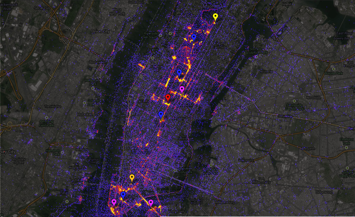
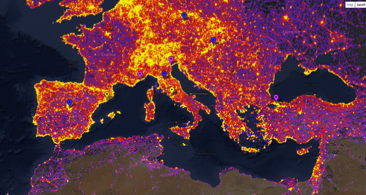
A new product by Google Panoramio, http://www.sightsmap.com, lets you see the most visited places on earth based on the number of panoramio photos each place has in the form of a heatmap. The dark areas have few photos, the red areas have more, and the yellow areas have a large number of geotagged photos.
The hottest places have markers linked to photos, Streetview, Wikipedia, Wikivoyage, Foursquare and Google plus articles about the site. The place names are selected by the wikipedia readership numbers and foursquare check-ins.
There are also street level heatmaps available for the top 15,000 places in the world.
Bon Voyage!