Much of California’s southern mountain region is under an unprecedented blizzard warning—the first in over three decades—until Friday afternoon, the National Weather Service announced Feb. 23.
Mountains in several counties—Los Angeles, Ventura, San Bernardino, and Santa Barbara—fell within the weather service’s blizzard advisory, with “heavy snow, winds gusting up to 80 mph, and near zero visibility” expected in Los Angeles and Ventura County Mountains on Thursday.
In addition to a blizzard warning, the weather service also issued a winter storm warning in the days earlier that is forecasted to last until 4 a.m. on Friday—while the blizzard warning will still be in place until 4 p.m for those areas—with anticipation of “strong winds and very cold wind chills.”
Other areas under a blizzard warning include some central California regions, such as Tehachapi, Grapevine, and Frazier Mountain.
Harsh weather conditions are expected to worsen into the weekend.
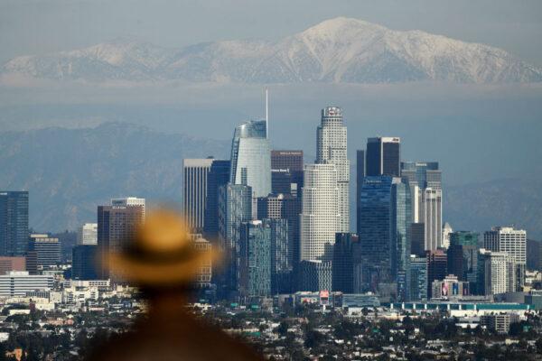
Snow is expected to fall particularly low between 1,500 and 2,000 feet in the Los Angeles County Mountains, reaching up to 4,000 feet.
“This is going to be a notable intense storm in Southern California, highly dynamic and bring heavy rain at low elevations and strong winds along with some thunderstorms,” he said.
Heavy rain could cause flooding in some rivers and streams, the weather service said, and surfers and beachgoers should avoid swimming as dangerous rip currents and high tides are likely.
In preparation, the Los Angeles Department of Water & Power said Thursday “crews are ready to respond to potential power outages.”
Conditions that usually cause power outages, the water and power department said, are strong winds that pick up flying debris like tree branches, heavy rain, and uprooted trees that may fall on power lines.
Friday is expected to bring more rain and snow, with heavy snow forecasted in the afternoon—up to 11 inches—the weather service said. However, Swain predicts that it will be more like 3 to 7 feet of snow in the mountains.
“This well may be the largest single-event snowfall in some parts of Southern California since the 1980s,” Swain said, adding that there will be a high risk of avalanches in the mountains.
Swain said non-mountain communities across California will likely see small hail mixed with rainfall accumulating over the next few days.
“If you were standing at the Hollywood sign, you probably would experience flakes falling from the sky at the very least,” Swain said.
Residents in Los Angeles began posting videos to social media Thursday afternoon of the rare sight of light snowfall in their neighborhoods.
“The current weather at my house in LA County is a mix of ice, hail, snow, and terrified birds,” one user wrote.
Another user wrote, “What is going on? Hail, Snow, Winter storm, Blizzard Warning in ‘Sunny’ Los Angeles, CA!”
The advisory for Southern California mountain communities said due to the weather, travel would be “very difficult to impossible,” with some drivers getting a taste of that earlier in the week when the I-15 Freeway between Mountain Pass and the Nevada state border was temporarily shut down Tuesday night due to rain and snow, creating icy road conditions. The freeway was closed in both directions.
Drivers were encouraged not to drive on canyon roads along the famed Pacific Coast Highway in Malibu as well, as “dangerous mud and rocks will likely cause extended closures,” the weather service said Wednesday.
By Thursday, the weather service warned travel should be limited to emergencies only in those areas.
“If you must travel, have a winter survival kit with you. If you get stranded, stay with your vehicle,” the weather service said.
The Los Angeles County Sheriff’s Department also issued a warning Thursday afternoon, pleading with residents not to be tempted to go to the mountains as road conditions—both wet and icy—will be “treacherous.”
“While this rare storm will bring beauty, it will also bring chaos,” the department said in a statement. “It may be tempting but please avoid the mountains.”
The last time the Golden State’s southern mountain region experienced a blizzard warning was Feb. 4, 1989. According to the Los Angeles Times archives, snow fell upon coastal Malibu and the Palm Springs desert canyon, causing widespread traffic jams as drivers skidded through snowy road conditions.