Severe Storms Threaten a 1,600-Mile Stretch of the US the Worst May Hit New York City

Severe Storms Threaten a 1,600-Mile Stretch of the US the Worst May Hit New York City
Intense storms that spread Wednesday morning across parts of the Midwest and Great Lakes will become more widespread into the night.(CNN)
6/3/2020
Updated:
6/3/2020

Clusters of strong to severe storms are likely Wednesday afternoon and evening from the northern Plains to the Atlantic Ocean—roughly a 1,600-mile stretch—including in major cities that in recent days have become hubs of protests over the death in police custody of George Floyd.

“Strong storms are expected in many cities that have seen nightly protests over the past several days,” CNN meteorologist Brandon Miller said. “The timing of the storms in the Northeast in cities such as New York City and Philadelphia, which should move through between 3 p.m. and 7 p.m., could keep” protesters indoors.
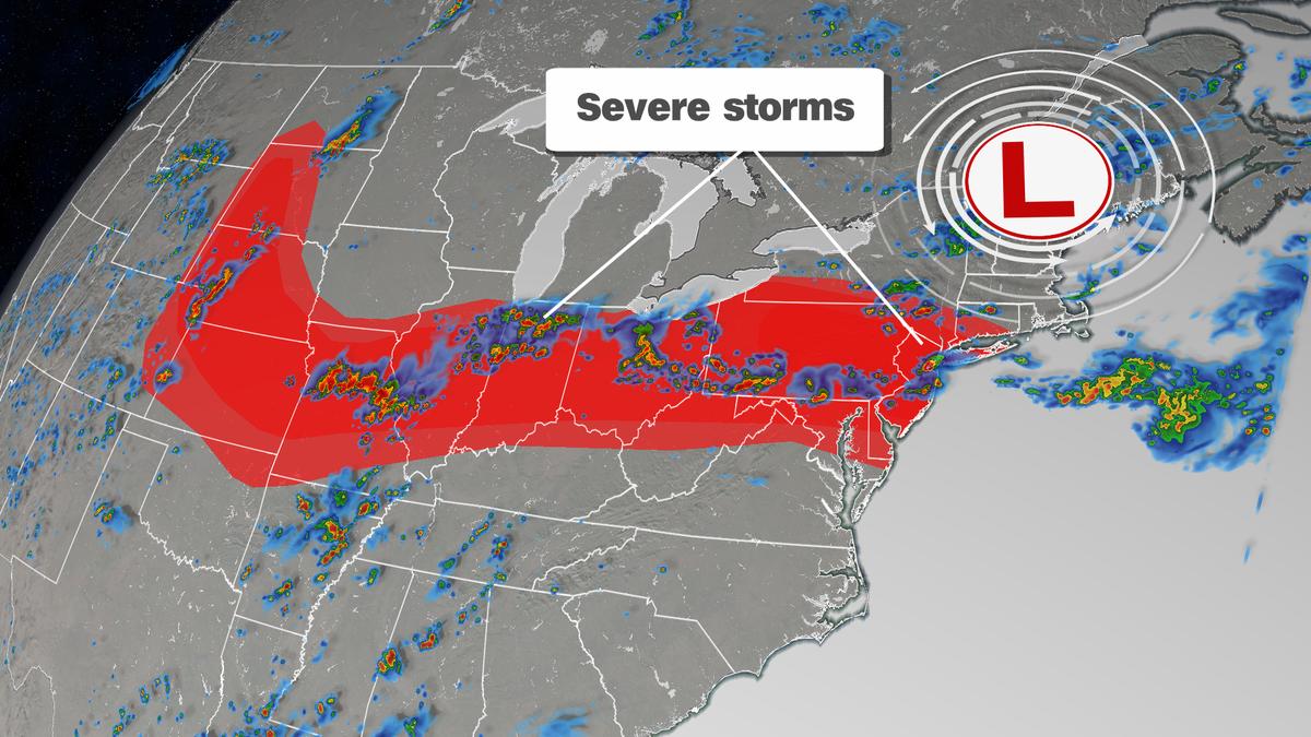
Intense storms were already happening Wednesday morning across parts of the Midwest and Great Lakes, CNN meteorologist Dave Hennen said. These storms will become more widespread into the night.

“The greatest threat for severe storms—where there is a level 3 of 5, enhanced risk—includes Philadelphia, Newark, (New Jersey), and New York City,” Hennen said.

This enhanced risk area includes over 28 million people. Damaging winds are the primary threat, with hail and tornadoes also possible.

“The storms across the Northeast today will be moving fairly quickly,” CNN meteorologist Chad Myers said. “This will reduce some flooding possibilities but also limit reaction time to get inside.”

These storms could catch people off guard, especially if they are outside.

A level 2 of 5, slight risk, covers a wider zone, including major cities like Kansas City, St. Louis, Indianapolis, Columbus, Cleveland, Pittsburgh, and Baltimore.

And it isn’t just storms. The summer heat is building, and above-average temperatures stretch from coast to coast.

Places like Washington could see record high temperatures.(CNN)

Places like Washington could see record high temperatures.

“While Washington DC is not likely to see storms this afternoon, it will be the hottest day of the year so far, reaching the middle 90s, which brings a heat stress threat for those outside,” Miller said.

The above-average heat will continue Thursday across about two-thirds of the continental United States. Severe storms will also be possible again, although a little further south across the East Coast.

Thursday’s severe risk will stretch from the Central Plains—the area with the highest risk—to the Mid-Atlantic.

The CNN Wire contributed to this report.