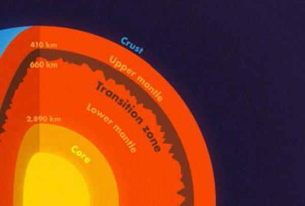
Scientists have discovered mountains as rugged as the Rockies 410 miles deep inside the earth, providing new insight into what happens deep beneath the earth’s crust.
The rough terrain at the boundary of two of the earth’s liquid inner layers was detected by analyzing data from an earthquake in Bolivia 25 years ago. That earthquake—the second largest deep quake ever recorded—shook the planet like a bell, sending out shockwaves that bounced off the planet’s inner topography and left their tell-tale data scattered on seismographs around the world.
The researchers believe that the mountainous layer could be formed of piled up slabs of seafloor that sunk down through the mantle intact after breaking off from the earth’s crust as it slid under the continental plates—helping answer a long-debated question.
“To find 2-mile elevation changes on a boundary that is over 400 miles deep using waves that travel through the entire Earth and back is an inspiring feat. … Their findings suggest that as earthquakes occur and seismic instruments become more sophisticated and expand into new areas, we will continue to detect new small-scale signals which reveal new properties of Earth’s layers.”
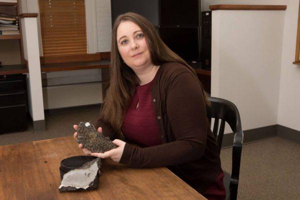
The research was carried out by seismologists at Princeton University.
One of the researchers Wenbo Wu said that the mantle mountains had “stronger topography than the Rocky Mountains or the Appalachians.”
Ultrasound For Planets
Just as ultrasound uses waves that bend and bound around different tissues and densities to reveal the inner world of a human womb and unborn baby, so too can the inner world of the earth be revealed—if you have big enough waves to beam into it.Only the most powerful earthquakes can provide strong enough waves, said co-author of the study Jessica Irving, noting that energy increases 30-fold with every step up the Richter scale. She gets her best data from deep earthquakes that are magnitude 7.0 or higher.
Deep earthquakes “instead of frittering away their energy in the crust, can get the whole mantle going,” she said.
For their study, they picked the second-largest deep earthquake ever recorded that shook Bolivia in 1994, reaching 8.2 on the Richter scale.
“Earthquakes this big don’t come along very often,” she said. “We’re lucky now that we have so many more seismometers than we did even 20 years ago. Seismology is a different field than it was 20 years ago, between instruments and computational resources.”
The researchers say their analysis shows the mountainous layer is actually reflecting a chemical difference—in other words, it is formed of a different type of rock.
“What could cause significant chemical differences? The introduction of rocks that used to belong to the crust, now resting quietly in the mantle,” said a statement from the University of Princeton.
“Scientists have long debated the fate of the slabs of seafloor that get pushed into the mantle at subduction zones, the collisions happening found all around the Pacific Ocean and elsewhere around the world. Wu and Irving suggest that remnants of these slabs may now be just above or just below the 410-mile (660-km) boundary.”