A tropical storm warning was issued for Bermuda in the early afternoon of Aug. 21, and North Carolina’s Outer Banks is still waiting for water levels to reach their peak as Hurricane Erin continues its northeast run offshore.
Hurricane-force winds (74 mph and greater) were recorded 105 miles away from the storm’s center, and tropical storm-force winds (39 mph–73 mph) extended as far as 320 miles away.
While the National Hurricane Center says the storm is pulling farther away from the United States throughout the day, it continues to have a dangerous effect.
For the past several days, the storm’s counterclockwise churn has thrown wind and waves at North Carolina’s iconic barrier islands and other parts of the U.S. East Coast from Florida up through the Mid-Atlantic.
Storm surge warnings of one to three feet have also been issued from Surf City, North Carolina, through Virginia Beach, the lower Chesapeake Bay, the Jersey Shore, up to Montauk Point, Long Island.
A tropical storm warning remained in effect for most of the North Carolina and Virginia coastline from Beaufort Inlet, south of Cape Hatteras, through Kitty Hawk and Virginia Beach up to the Maryland state line.
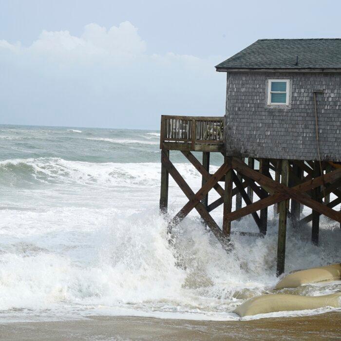
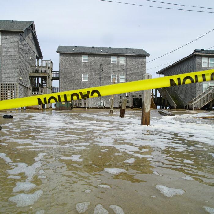
But the Outer Banks of North Carolina continue to face the biggest impact.
Consistent exposure to that size of swell is expected to cause significant erosion to the beach and cause significant overwash of water stretching beyond the beach.
A storm surge warning also remains in effect, with areas expecting to see water inundation greater than three feet above what is normally dry ground.
The highest water levels are expected to be reached around 7 p.m. (ET), coming in with the high tide.
The most significant impacts occurred in Buxton and Hatteras Village.
When the island does reopen, Dare County announced that it will do so in stages, beginning with “essential personnel,” including utility, government, medical, and damage assessment personnel, will be allowed in.
Second will be “permanent residents and essential personnel for critical businesses” such as grocery stores, gas stations, pharmacies, and banks.
Non-resident property owners and non-resident employees of “non-critical businesses” will then be allowed in, followed by the general public.