April 11 will be just another day for most Canadians, but in fact it marks the 110th anniversary of an agreement that has contributed much to the peace, security, and prosperity of both Canada and the United States.
On that day in 1908, a treaty with the simple name of Treaty of 1908 was signed by two parties: the United Kingdom (on behalf of Canada) and the United States.
The 1908 treaty—the last of a long series of complicated and often acrimonious negotiations that laid the foundations of this division of territory—refined and shaped the Canada-U.S. border to its present form.
But the border as we know it today did not come about in a few easy steps—it was established in stages that took over a century of negotiation and compromise on the part of both countries.
Two civilian organizations, the International Boundary Commission (IBC) and the International Joint Commission (IJC), are responsible for maintaining the land and water portions of the boundary, often described as the longest undefended border in the world.
After the IBC was created in 1908 and the IJC the following year, Canada and the United States each assigned their own expert geographer or surveyor to serve as commissioner, and that’s still the case today. Their roles were to accurately define and mark the boundary separating the two countries—a massive undertaking.
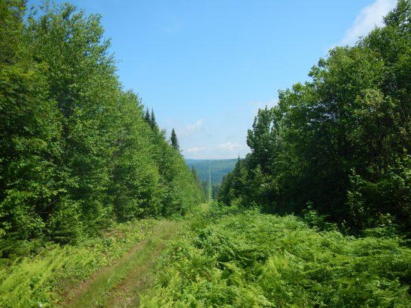
The 49th parallel was set as the boundary and the line was supposed to be as straight as possible, despite running through uncharted wilderness in many regions.
Today the International Boundary, as it’s officially known, stretches 8,891 kilometres with more than 8,000 monuments in all. It is six metres wide, a tract known as the vista, and this area is always kept deforested.
According to the IBC, which is responsible for maintaining the monuments and other markers, the vista must be entirely free of obstruction and plainly marked for the proper enforcement of the laws of Canada and the United States.
“This affects many things such as hunting and fishing rights and cellphone towers,” says Joe Harrietha, a senior surveyor with the IBC. “It’s important, because people need to know at what point Canadian laws apply and where these things come under U.S. laws.”
Harrietha explained that the establishment of the two organizations meant issues that arose could be handled directly by Canada and the United States “without the necessity of continual British involvement.”

War or peace?
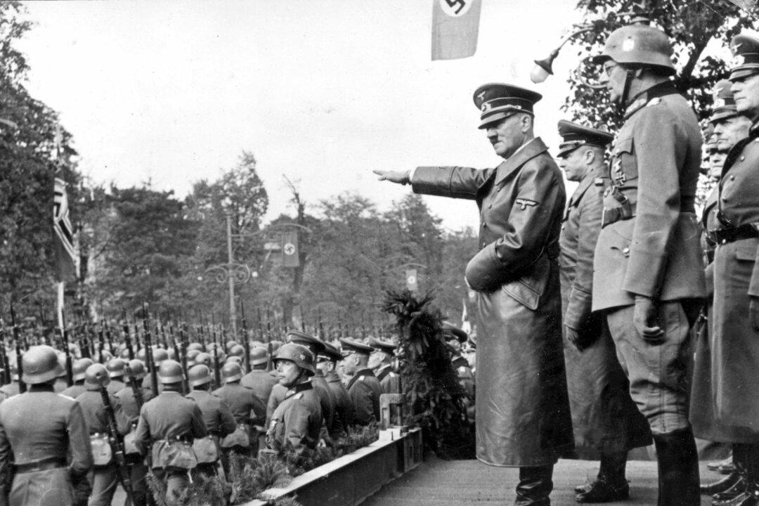
The Canada-U.S. demarcation line symbolizes the remarkable success of peaceful negotiations between two nations. With no military personnel standing by ready to defend it against attack, it stands in sharp contrast to many other international borders that are guarded by heavily armed troops.But over 125 years of treaty negotiations—there were six treaties between 1783 and 1908 that aimed to settle various disputes and conflicts—things were often anything but harmonious. In fact, the two countries were on the brink of war during the time of U.S. President Theodore Roosevelt and Canadian Prime Minister Wilfrid Laurier, when a dispute over the Alaska Panhandle (the territory between southeastern Alaska and the British Columbia coast) took a heated turn.
Stephen Azzi, head of the political management program and specialist in Canada-US relations at Ottawa’s Carleton University, says Roosevelt threatened to send troops to the border. “I am going to get ugly,” the president reportedly said.
Military intervention was averted, however.
“The dispute was settled by arbitration, and the final resolution was largely in favour of the U.S.,” says Azzi. “This was one of the factors that led to the treaty of 1908 that established the boundary as we have it today.”
“Both countries recognized that this was the right time for a great North American economic and social partnership to begin,” says Harrietha.
In 1925, Canada and the United States agreed to make the IBC permanent, tasking it with maintaining the land and monuments along the border. The IJC monitors the transboundary environment such as water and air quality.
Longest undefended border
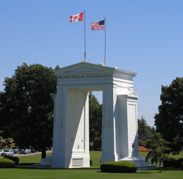
“By 1912, 100 years after the War of 1812, armed conflicts of the past between the two countries were forgotten, and the myth of the longest undefended border in the world began to unfold,” says Norman Hillmer, a professor of History and international affairs at Carleton University.The inscriptions on the Peace Arch, one of the monuments marking the border between British Columbia and Washington State, echo the theme of the peaceful and cooperative relationship between Canada and the United States. On the United States side a plaque says “Children of a Common Mother” while a plaque on the Canadian side reads, “Brethren Dwelling Together in Unity.”
Hillmer says that although the border remains open and undefended in a military sense, both countries obviously have measures in place to strike a balance between security and the smooth flow of trade.
Some remaining loose ends
Although it took a long time to settle the matter of who got what in the treaty negotiations, there are a few regions still in dispute. Among them is the tiny Machias Seal Island in the Gulf of Maine, the maritime boundary at the Dixon Entrance between Alaska and B.C., and the Northwest Passage, which Canada claims ownership of but Washington maintains is in international waters.In 1949 there was talk about Point Roberts seceding from the United States and joining Canada, but nothing came of it in the end.