")
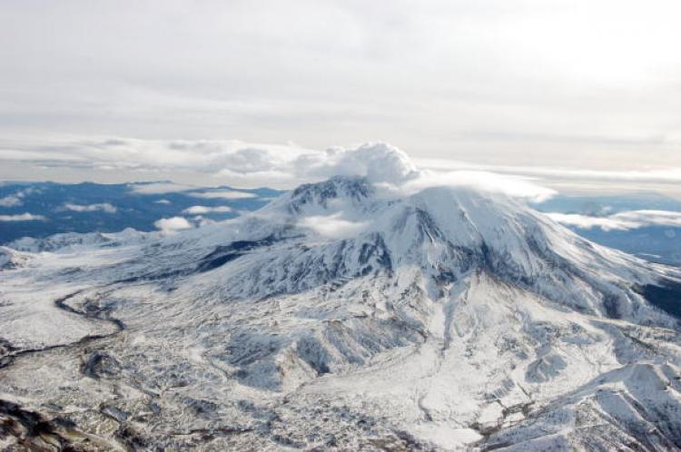
Thirty years ago today, at 8:32 a.m., the bulging flank of Washington’s Mount St. Helens slid away in the most massive landslide in the history of the US. What ensued moments after was an eruption that fully changed scientists’ understanding of volcanoes and volcanology.
The volcano shot 520 million tons of ash eastward across the US, creating darkness in the daylight hours in Spokane, a city lying 250 miles away from the eruption site, according to a statement released by the U.S. Geological Survey. “Water from melting snow and ice mixed with loose rock debris to form lahars—volcanic mudflows—that poured down river valleys ripping trees from their roots and engulfing roads, bridges and houses,” the release said.
“The spectacular nature of the May 18, 1980, eruption is one of those unforgettable time markers for anyone who lived through the effects of the eruption or saw the images through the media,” Carolyn Driedger, hydrologist and outreach specialists at the Cascades Volcano Observatory (CVO), said in the release.
The eruption took the lives of 57 people, including that of David A. Johnston, a scientist observing the northern bulge.
The eruption of Mount St. Helens after 123 years of dormancy did more than increase interest in volcano science and monitoring. It also brought to the surface the need for improvement in how those involved plan for eruptions, says the release.
Prior to Mount St. Helens’ eruption, volcanologists’ studies were confined to Hawaii. The frequent eruptions there provided scientists with good data to explore the correlation between monitoring signals and impending eruptions. It has also become an ideal spot for scientists to experiment new tools and hypothesis about volcanic behavior.
“Since 1980, hundreds of scientists have visited Mount St. Helens. Many of these scientists have made geological and biological studies of other volcanoes in the U.S. and its territories; others returned to volcanic homelands across the globe to apply their new knowledge,” said Cynthia Gardner, scientist-in-charge at CVO.
“For a volcano whose name generally was unknown outside the Pacific Northwest before 1980, Mount St. Helens has given us a far-reaching and invaluable legacy.”