This copy is for your personal, non-commercial use only. Distribution and use of this material are governed by our Subscriber Agreement and by copyright law. For non-personal use or to order multiple copies, please contact The Epoch Times Reprints.
The National Weather Service (NWS) issued blizzard and winter storm warnings for portions Washington, Oregon, and California, while other forecasters say that system could track across the United States this week. Weather.gov
The National Weather Service (NWS) issued blizzard and winter storm warnings for portions of Washington, Oregon, and California, while other forecasters say that system could track across the United States this week.
Blizzard warnings were issued for parts of the Sierra Nevada areas in eastern California, while winter storm warnings were in effect for Northern California, western Oregon, and a small section of Washington state, according to a map posted Tuesday by the NWS.
“Heavy snow and strong winds will create extremely dangerous travel conditions across the Sierra Nevada,” it also said Tuesday, adding, “mountains from southern Oregon through California will see heavy snow rates of 2 to 3 inches per hour and additional snowfall of 2-4 more feet for the Sierra Nevada and southern California ranges through Wednesday. Blizzard conditions will make for dangerous to impossible travel.”
Forecasters with other services say the storm will eventually spread across the United States and bring snow and ice into the Midwest and East Coast later this week.
“Arctic air will be absent from this system when it initially moves across the central United States, which means the heavy snow threat will need to be generated mainly through the strength of the storm itself,” AccuWeather’s Matt Benz stated. “An intense storm can overcome a warm atmosphere to generate heavy snowfall, but if this storm is slow to strengthen, snowfall may not be especially heavy over the Central states.”
That system, according to AccuWeather’s forecast, could bring upwards of 18 inches in Upstate New York and the northern reaches of New England on Friday and Saturday.
“A storm that tracks from the southern Plains to the Ohio Valley and central Appalachians will keep the heaviest snow closer to the Great Lakes, upstate New York and northern New England,” AccuWeather’s Courtney Travis noted. “A more southern track would bring the opportunity for heavier snow to the central Appalachians, mid-Atlantic and southern New England.”
Meanwhile, one of the most significant snowfall events of the season hit the Northeast on Monday night and Tuesday morning, with New York City seeing upwards of 5 inches of snow.
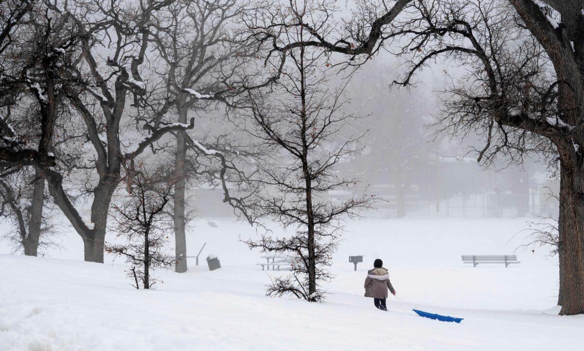
A person drags a sled through the snow at Frazier Park in Calif., on Feb. 27, 2023. David Crane/The Orange County Register via AP
Hundreds of schools across southern New England either closed for the day or delayed opening as the most significant snowfall of what has been a mild winter hit overnight. As much as 7 or 8 inches of snow blanketed some communities by sunrise.
Most flight cancellations or delays were concentrated in the Northeast. There were over 470 flight cancellations in the United and more than 900 delays by midmorning, according to FlightAware.com.
A winter storm warning covered parts of the Northeast, including Connecticut, New York, Massachusetts, New Jersey, and Rhode Island, with heavy snow forecast through Tuesday afternoon. The Albany, New York, area saw less snow than expected—2 to 5 inches—but enough to close schools.
Jack Phillips is a breaking news reporter who covers a range of topics, including politics, U.S., and health news. A father of two, Jack grew up in California's Central Valley. Follow him on X: https://twitter.com/jackphillips5