
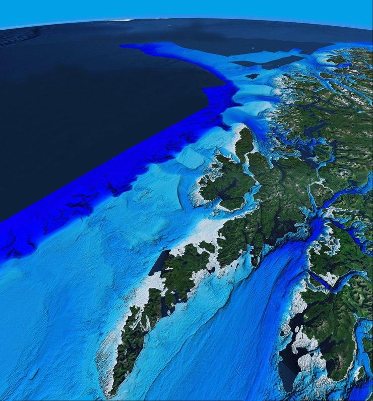

To date, the Norwegian MAREANO project has mapped almost 30,000 square miles of the ocean floor in the Barents Sea and the areas outside the Lofoten Islands in the Arctic Circle. The information being accessed for the first time ever, will be used to study the consequences of human activity on ocean ecosystems.
The mapping project offshore Norway started 10 years ago and in 2005, the MAREANO program was launched. By the end of 2012, they will have scanned almost 33,000 square miles off the northern coast of Norway, the Barents Sea, and the northern Norwegian Sea.
Six weeks per year, the program is out at sea, mapping depth, seabed conditions, biodiversity, biotopes, and pollution in the sediment. Among the techniques used, multi-beam echo sounders gather detailed information about the seabed’s topography. A box-corer collects seabed samples in order to study sediment composition.
“We know far more about the surface of the planet Mars than about the seabed right outside our coastline!” reads the project’s website, giving a sense of the scope of the discoveries.
A huge array of hitherto unknown creatures and cold-water coral reefs has already been discovered.


