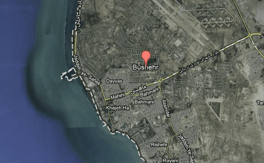
A 6.3 magnitude earthquake shook Iran at 11:52 GMT ( 7:52 a.m. EST) according to the Unites States Geological Survey (USGS).
Local media has reported three dead so far, according to Al Jazeera.
The quake epicenter was in the city of Bushehr, where Irans only nuclear plant is located.
Governor of Bushehr, Fereydoun Hassanvand told Iranian state television that there has been no damage to the plant, according to local sources.
Iran’s International Institute of Earthquake and Seismology (IIES) has been aware of the risks presented by the location of Iran’s Nuclear plant for some time.
After the 2012 earthquake in Japan caused a meltdown at Fukushima Daiichi nuclear power plant, the IIES released a diagram showing the proximity of Bushehr to Gulf capital cities.
The quake was felt as far away as Qatar and Saudi Arabia.
The Earthquake was 10 km (6 mi) below the surface.
The USGS has reported several aftershocks in the region up to 5.3 magnitude.


