The National Hurricane Center (NHC) is issuing advisories for Hurricane Willa and Tropical Storm Vicente.
Hurricane Willa
The NHC said in its 8 a.m. update that Hurricane Willa is an “extremely dangerous” storm with 155 mph winds—enough to make it a strong Category 4 system. Hurricane Michael, which hit the Florida Panhandle earlier this month, had 155 mph winds (the above video shows the aftermath of Michael’s devastating winds in Florida).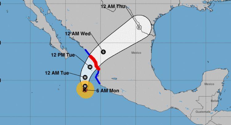
The NHC said in its 8 a.m. update that Hurricane Willa is an “extremely dangerous” storm with 155 mph winds, enough to make it a strong Category 4 system NHC