Hurricane Danielle Forms in Atlantic, First of 2022

Hurricane Danielle Forms in Atlantic, First of 2022
A satellite image shows Tropical Storm Danielle in the Atlantic at 12 p.m. ET on Sept. 1, 2022. (NOAA)
Jack Phillips
9/2/2022
Updated:
9/2/2022
0:00

The first hurricane of the 2022 Atlantic season formed on Friday morning, according to the National Hurricane Center (NHC) in an update.

Hurricane Danielle—a Category 1 storm with 75 mph winds—poses no threat to land, officials said. No watches or warnings were issued in connection to the storm as it is located in the middle of the northern Atlantic Ocean, according to the update.
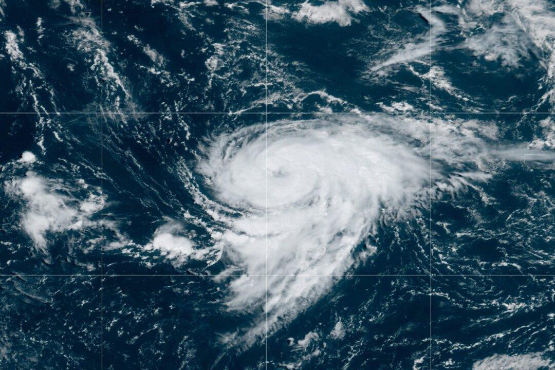
The center of Danielle is located about 800 miles west of the Azores islands and is moving west at 1 mph.

“The hurricane is forecast to meander over the open Atlantic during the next couple of days, then slowly turn toward the northeast early next week,” said the Hurricane Center in an 11 a.m. update.

“Some additional strengthening is forecast during the next couple of days. Hurricane-force winds extend outward up to 15 miles (30 km) from the center and tropical-storm-force winds extend outward up to 115 miles (185 km). The estimated minimum central pressure is 992 mb (29.30 inches),” it said.

Danielle is the first named storm since July 3 when Tropical Storm Colin formed. Since Colin, there have been no named storms since Colin throughout either the months of July, meteologists and researchers said earlier this week.
“For the first time since 1941, the Atlantic has had no named storm (e.g., tropical storm or hurricane) activity from July 3rd-August 30th,” wrote Colorado State University hurricane researcher Phil Klotzbach on Twitter.

Other Developments

The next system that becomes a tropical storm in the Atlantic basin will be named Earl, according to the National Weather Service.
On Friday, the NHC said it is monitoring a storm system east of the Leeward Islands near the Caribbean that has a 50 percent chance of developing into a tropical depression over the next 48 hours and a 70 percent chance of doing so over the coming five days.

“Shower and thunderstorm activity has slightly increased since yesterday in association with an area of low pressure located several hundred miles east of the Leeward Islands,” the agency said at 8 a.m. Friday. “However, overnight satellite-derived wind data indicate the circulation remains broad. Although environmental conditions are only marginally conducive, any additional development of the system over the next few days would lead to the formation of a tropical depression.”

That disturbance, the Center said, is forecast to move to the west-northwest.

There is also a disturbance near the west coast of Africa near the Cabo Verde Islands that has only a 10 percent chance of forming into a depression, NHC officials said Friday.

Jack Phillips is a breaking news reporter with 15 years experience who started as a local New York City reporter. Having joined The Epoch Times' news team in 2009, Jack was born and raised near Modesto in California's Central Valley. Follow him on X: https://twitter.com/jackphillips5
twitter
Related Topics