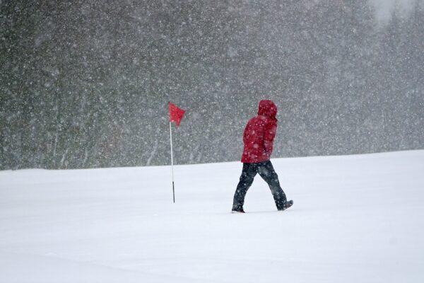
Blizzards are set to cause “significant disruption” in the UK on Thursday night and Friday morning.
The Met Office has issued amber warnings highlighting further snowfall for central and northern England, northern Wales, and eastern parts of Northern Ireland.
Three yellow warnings for snow are also in place, covering much of the rest of the nation, with the exception of southern England and western Scotland.
Met Office Chief Meteorologist Jason Kelly said: “The boundary between milder and colder air is gradually moving north, with some heavy and persistent snow likely at times on the northern edge of this boundary. Snow has already settled quite widely in central parts of the UK and further accumulations are likely even to lower levels with disruption most likely for those within the amber warning areas.
“With some strong winds accompanying these snow showers, blizzard conditions are likely for a time in northern England and Wales, as well as parts of Northern Ireland. Ice will be a continuing hazard for many in the forecast period, with very low overnight temperatures likely to exacerbate continued likely travel disruption.”
The UK Health Security Agency (UKHSA) has issued a Level 3 Cold Weather Alert for the whole of England.
Agostinho Sousa, UKHSA’s head of extreme events and health protection, said: “During periods like this, it is important to check in on family, friends, and relatives who may be more vulnerable to the cold weather, as it can have a serious impact on health.
“If you have a preexisting medical condition or are over the age of 65, it is important to try and heat your home to at least 18 degrees Celsius if you can.”
‘Treacherous Conditions’
The worst of the weather may be seen in northwest Wales and northern England, where gusts of 50 mph and 30 to 40 cm of snow are expected, according to Met Office Meteorologist Alex Burkill.He said: “The combination of heavy snow and gales is why we’re likely to see blizzards and drifting snow which causes extra hazards on the roads. In places covered by amber warnings, there will be very difficult, treacherous conditions.”
Burkill said motorists should “ideally avoid travelling in those periods,” adding, “If you have to head out then be aware that journeys could take significantly longer.”
He added that while Devon and Cornwall should be free from the snow, the region is predicted to be hit by the strongest winds of around 60 mph on Thursday evening.
People in the south of England are likely to experience the worst of the rain.
Thursday night temperatures will be similar to Wednesday, which was the coldest night of the year, before even colder conditions move in on Friday night.
Burkill said that areas of the Scottish Highlands could see minus 17 degrees Celsius, after this year’s record low of minus 16 degrees Celsius was recorded at Altnaharra in the region.
Met Office forecasters said this was also the lowest March temperature seen in the UK since 2010, when minus 18.6 degrees was recorded at Braemar in Aberdeenshire.
The coldest March night on record was minus 22.8 degrees at Logie Coldstone in Aberdeenshire on March 14, 1958.
Meanwhile, the warmest overnight temperature for the mainland was 9.8 degrees at Culdrose in Cornwall, while 10.8 degrees was recorded at St. Mary’s Airport on the Isles of Scilly.
Travel Chaos
National Highways issued a “severe weather alert” for snow covering the northeast, northwest, and Midlands regions until 8 a.m. on Friday, where motorists have been warned not to drive unless their journey is essential.Motoring group RAC said that on Thursday morning there were 50 percent more breakdowns than usual in areas affected by snow, with some drivers stuck in the snow in parts of South Yorkshire and Wales.
The group’s breakdown spokesperson Rod Dennis said: “Rural routes through central and northern England covered by the Met Office’s amber weather warning are also starting to get difficult to negotiate, and these are areas drivers should avoid if they can.
“Given the weather, we recommend thinking carefully before setting out today as, with more snow forecast, things are likely to get worse on the roads before they get better. These aren’t conditions anyone wants to be caught out in, so those who have to drive need to be confident on potentially slippery surfaces, have ensured their vehicles are up to the task, and are carrying an emergency breakdown kit so they can stay warm and communicate easily should they get stuck or break down.”