Remarkable new details about a giant moose geoglyph have been released as archaeologists confirm it is the world’s oldest known geoglyph.
From The Siberian Times: Children were involved in the construction of a geoglyph in the Ural mountain range in western Russia. The geoglyph is a giant moose outlined with stones and it was discovered in images taken from space. It predates Peru’s famous geoglyphs, the Nazca Lines, by thousands of years.
But archaeologists still don’t know what its meaning or purpose is and which ancient civilization made it; archaeological traces found so far in the area do not show a culture with sufficient refinement to have made the geoglyph.

Was it made to impress the gods or did it have some other purpose?
Experts have been examining the giant moose since it was discovered in 2011 and have now confirmed it is the world’s oldest geoglyph. Two years ago, researchers had estimated the site could date back as far as 6,000 B.C. based on the style of the stone-working, known as lithic chipping, but after carbon dating it is now thought to date from between 3,000 and 4,000 B.C. Located near Lake Zyuratkul in the Ural mountains, it stretches about 275 meters (900 feet) and depicts an animal with four legs, antlers, and a long muzzle.

Perhaps the most interesting development is that tools found at the site indicate it was worked on assiduously by children as well as adults in a large-scale community effort. Of 155 tools found beside the geoglyph, the majority were used for digging or breaking stones.
Stanislav Grigoryev, a senior researcher from the Chelyabinsk History and Archaeology Institute, said: “Judging by the different sizes of the tools ... we can assume they were used by both adults and children. We can also assume it means that everyone participated in creating the moose.
“But it was not a kind of slave labor of children. They were involved to share common values, to join something important to all the people.”

The moose was discovered by chance in 2011 by local researcher Alexander Shestakov after he spotted it while trawling through satellite images from Google Earth. He alerted archaeologists, who sent out a hydroplane and paraglider to survey the area before making the first ground expedition to the site. The geoglyph was found 200 kilometers (124 miles) west of Chelyabink, in the Zyuratkul National Park, situated on a terrace at an altitude of 860 meters (2,800 feet).
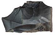
Initial fieldwork found simple techniques were used to create the moose, with turf and earth dug out in channels 10 meters (33 feet) wide to make its shape before it was filled with stones. “The figure would initially have looked white and slightly shiny against the green grass background,” Grigoryev said.

Slightly different methods were used to make the various parts of the geoglyph. For instance, a mix of clay and crushed stone was used to make the hooves. When part of the hind leg was excavated, archaeologists found the largest stones were on the edges, with the smaller ones inside.
While the geoglyph is similar in some regards to the world-famous Nazca Lines in Peru and to geoglyphs in England, such as the White Horse in Oxfordshire or the Dorset Giant, the experts believe there are no links.
Discovered in 1927, the Nazca Lines feature hundreds of lines, shapes, and animal designs, the earliest of which are believed to have been created around 500 B.C. The Russian moose was drawn in a style more similar to petroglyphs found in Finland, however, than to the Nazca Lines (the word petroglyph refers to drawings or carvings in rock, whereas geoglyph refers to drawings or carvings on the Earth).
Excavations in the surrounding area could provide further clues as to its origins and to the people who made it. Radiocarbon dating has been carried out, narrowing down the period in which the geoglyph was created to between 3,000 and 4,000 B.C.

But further testing is needed—for example, researchers plan to use optically-stimulated luminescence dating as well as pollen analysis. Grigoryev said: “It may help if we find ceramics on the site. Ceramics could help us with the date and with understanding who these people were that created the geoglyph. It’s not quite clear who the builders were. It is obvious that its creation has great social importance. Geoglyphs are the symbols of unity.”
“In the Neolithic and Eneolithic Ages, hunters and fishermen lived in this area,” he said. “We conducted archaeological investigations on the site of a settlement nearby, on the lake shore, assuming that the builders of the geoglyph might have lived there ... but there was no sign of large social structures, nor signs that they did anything other than hunting and fishing.”
“It puzzles me a lot, I keep thinking about the people that built the geoglyph and their purpose,” Grigoryev mused.
The research team found traces of two ancient fireplaces at the site of the moose, both used only once, possibly in a significant ritual. Despite many unanswered questions, Grigoryev warned against future large-scale excavation and said officials should consider preserving the sanctity of the site.
“It could become a tourist attraction and with a museum, but we need to think how it might be implemented,” he said. An intriguing question is whether more geoglyphs will become visible as researchers analyze Google Earth in detail.
Some 50 geoglyphs of various shapes and sizes, including a massive swastika, were recently discovered across northern Kazakhstan.
Theories About Geoglyphs
1. Worship
Without the advanced tools to make statues, geoglyphs may have been primitive forms of statues to be worshiped. This could certainly be true of the Long Man of Wilmington, in England, which is thought to date as far back as 2,000 B.C. and is the tallest geoglyph in Europe. Some experts say the figure is a representation of an Anglo Saxon war god and the site is considered sacred by Pagans.

2. Astronomy
A handful of archaeologists believe geoglyphs could have been drawn to represent the important stars, planetary events such as sun solstices, or constellations. However, a 1968 study by the National Geographic Society found that while some of the Nazca lines did point to the positions of the sun and moon, it was no more than could be expected by mere chance.
3. Ancient Zip Codes
According to one theory, geoglyphs were used by ancient civilizations to mark territorial boundaries. More often than not, they are giant structures in areas that can be seen from a distance or from a high vantage point, leading some experts to say they were used to mark ownership of the land.
4. Prayer and Ritual Sites
The discovery of fireplaces at the Russian moose and other geoglyphs adds to speculation that they were used for rituals. There is a theory that the Nazca used to dance along the lines of their geoglyphs when they prayed for rain, with many of the same images featured on pottery from the time.
5. Aliens

A common, yet more bizarre, theory put forward about strange markings on the ground is that they were used by aliens. Many speculate that the straight lines of the Nazca, for instance, were created as runways for spaceships, but why extraterrestrials would attempt to land on geoglyphs in the shape of monkeys, spiders, or a giant Russian moose is another question.
Republished with permission from The Siberian Times. Read the original.