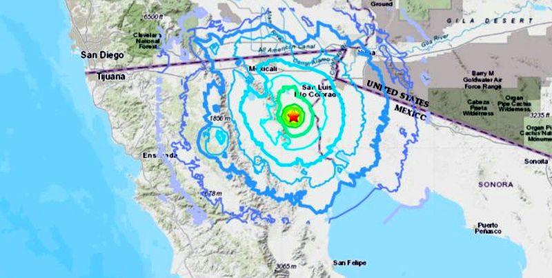
A 4.8 magnitude earthquake struck near the U.S.-Mexico border in Baja California, Mexico, and it was felt in San Diego and other parts of Southern California.
There were no immediate reports of damage or injuries.
Earthquake-Prone
Baja California, a peninsula in Mexico, is very prone to earthquakes. In 2010, a 7.2 magnitude quake known as the 2010 Baja California earthquake or the 2010 Easter earthquake struck near the same place as the Nov. 19 quake. The tremor lasted for more than a minute and was felt throughout the West Coast and in some southern states.Researchers in 2010 said at the time that the large quake could disturb nearby faults.
“In cases like this, that often means increasing stress on other faults, which makes them more prone to movement. The energy seems to be moving northward toward the San Andreas Fault. I don’t want to anthropomorphize, but it’s like this quake was goading the San Andreas.”
The 7.2 quake was preceded by a handful of smaller quakes known as foreshocks.
“Earthquakes don’t pay attention to international borders, which complicates our work,” USGS scientist Nancy King told the paper. “Most of the seismic activity appears to be originating south of the border, which means it’s harder to get good quake locations quickly. People are going to have to study the data. There will be field trips to the area, though that will probably take a day or two to coordinate.”
Abbot noted the quake was the same size as the devastating January 2010 Haiti earthquake that left between 100,000 and 160,000 people dead. The country is still recovering from the event years later.
“The big quake was double the size of the Haiti quake, but it doesn’t seem like there was a lot of damage caused, particularly in Mexico,” he said at the time. “That suggests that people are building better, or at least that past quakes have already knocked down the bad stuff.”
Meanwhile, Baja California and the rest of the West Coast are located on the Pacific “Ring of Fire,” the world’s most seismically active region. Some 90 percent of all earthquakes hit the Ring of Fire.