Region Battens Down the Hatches as Cyclone Forms in Queensland

‘We still are expected to see significant impacts from these winds.’
Region Battens Down the Hatches as Cyclone Forms in Queensland
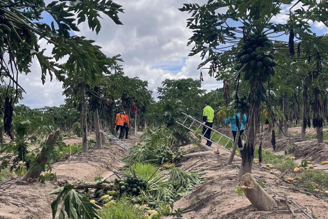
A supplied image shows farm staff removing over ripe fruit from trees damaged in the wake of Cyclone Jasper at Skybury Farms near Mareeba in Far North Queensland, December 21, 2023. Farmers are reporting significant crop losses and a long recovery ahead across far northern Queensland after Cyclone Jasper. (AAP Image/Supplied by Skybury Farms)
AAP
By AAP
1/24/2024
Updated:
1/24/2024
0:00

The long wait for Tropical Cyclone Kirrily is finally over.

Now north Queensland is bracing for its impact with damaging winds and heavy rain to lash the region as early as Wednesday night.
A tropical low finally developed into Cyclone Kirrily in the Coral Sea on Wednesday afternoon, days after it was first forecast to arrive.

Kirrily is set to cross the coast near Townsville between Cardwell and Bowen as a category 2 system on Thursday night, bringing destructive winds and “life threatening” flash flooding.

“People ...should get ready now,” Queensland Premier Steven Miles said.

Evacuation plans are in place for communities in Kirrily’s projected path while extra police, energy and emergency crews from across Queensland and interstate are on standby.

Townsville airport is set to close on Jan. 25 along with 120 schools as north Queensland bunkers down.

The first sign of Kirrily is set to be felt at the Whitsunday Islands with winds of 120km/h expected on Wednesday night.

Kirrily was initially forecast to arrive as a severe category 3 system.

But the Bureau of Meteorology warned against complacency about a category 2 cyclone.

Kirrily is still set to produce winds strong enough to damage homes, bring down trees and cause power outages, the bureau said.

“We still are expected to see significant impacts from these winds,” meteorologist Laura Boekel said.

Then there is the heavy rain and flooding.

“Dangerous and life-threatening flash flooding is possible near the centre and the south of that system,” Ms. Boekel said.

The 700km area between Innisfail and Sarina has been warned it may experience heavy falls and flooding from early Thursday.

People have been told to limit their travel in areas currently in Kirrily’s path.

Residents have also been asked to reconsider their Australia Day long weekend plans, with national parks between Cardwell and Airlie Beach temporarily closed from Wednesday.

Once Kirrily crosses the coast, it is expected to weaken as it heads inland.

However, the system is still set to cause devastation.

“It’s important to know it’s not just about that crossing but what the system will do once it has crossed the coast,” Ms. Boekel said.

The low is expected to bring widespread rain and flooding that may impact the state for days, with heavy showers set to hit central and western Queensland from Friday.

The southeast may also be affected indirectly by rain and potential flooding barely a month after a disastrous Christmas period.

Kirrily is the second cyclone to threaten Queensland in weeks.

Cyclone Jasper caused record flooding that devastated the far north in mid-December.

Severe weather then struck the state’s southeast, with seven people dying in storm-related incidents.

The back-to-back disasters have exceeded $743 million in insured losses, the Insurance Council of Australia said.

Fatigued emergency crews are still recovering.

However they have been bolstered by the arrival of more than 50 personnel from NSW and Victoria.

Meanwhile, Cyclone Anggrek is slowly moving away from the Cocos Islands off Western Australia.

The category two system is set to leave Australian waters on Jan. 25.

In WA, heavy rainfall up to 100mm and 90km/h winds have been forecast for parts of the Pilbara, Gascoyne, Goldfields and Southern Interior with a severe weather warning current.

Australian Associated Press is an Australian news agency.
Related Topics